


Mount Ruapehu Map: 9"
Made by
Print With Shapeways
 Choose Your Material
 Choose your color and finish
$314.66
Have a question about this product?
contact the designerYou must be logged in and verified to contact the designer.
Product Description
If you would like a custom relief map, contact me through my website or through Shapeways. Check out photos of my other 3D prints.
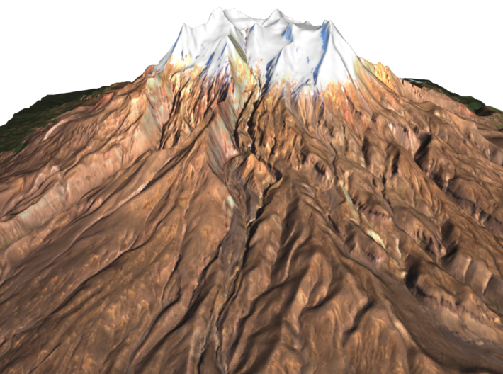
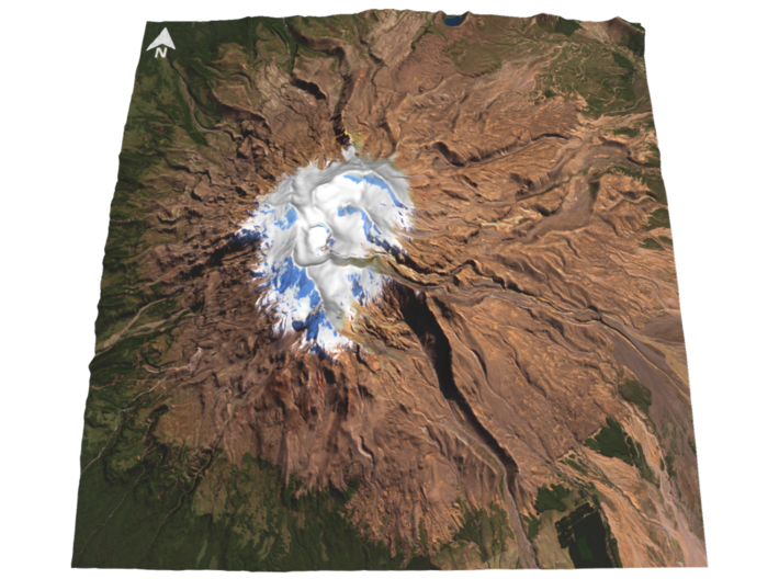
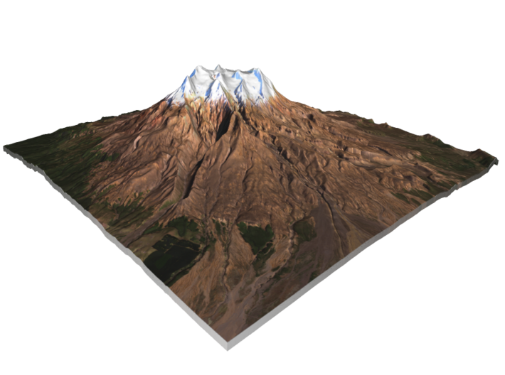
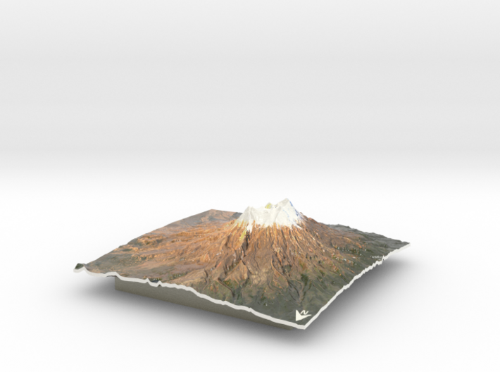
Mount Ruapehu, or just Ruapehu, is an active stratovolcano at the southern end of the Taupo Volcanic Zone in New Zealand. It is 23 kilometres (14 mi) northeast of Ohakune and 23 km (14 mi) southwest of the southern shore of Lake Taupo, within Tongariro National Park. The North Island's major skifields and only glaciers are on its slopes.
Ruapehu, the largest active volcano in New Zealand, is the highest point on the North Island and has three major peaks: Tahurangi (2,797 m), Te Heuheu (2,755 m) and Paretetaitonga (2,751 m). The deep, active crater is between the peaks and fills with Crater Lake between major eruptions.
Source: Wikipedia
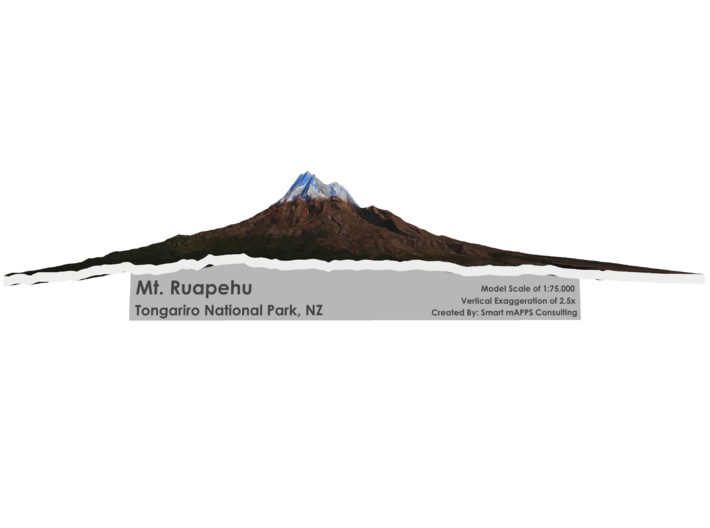
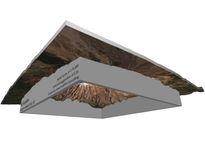
The model is created at a scale of 1:75,000 with 2.5x vertical exaggeration. It features a built-in base, so it sits perfectly on a desk or in a frame.
Model Data Sources: ESA, LINZ
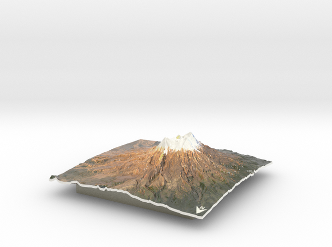
Mount Ruapehu, or just Ruapehu, is an active stratovolcano at the southern end of the Taupo Volcanic Zone in New Zealand. It is 23 kilometres (14 mi) northeast of Ohakune and 23 km (14 mi) southwest of the southern shore of Lake Taupo, within Tongariro National Park. The North Island's major skifields and only glaciers are on its slopes.
Ruapehu, the largest active volcano in New Zealand, is the highest point on the North Island and has three major peaks: Tahurangi (2,797 m), Te Heuheu (2,755 m) and Paretetaitonga (2,751 m). The deep, active crater is between the peaks and fills with Crater Lake between major eruptions.
Source: Wikipedia
The model is created at a scale of 1:75,000 with 2.5x vertical exaggeration. It features a built-in base, so it sits perfectly on a desk or in a frame.
Model Data Sources: ESA, LINZ
Details
What's in the box:
Mt-Ruapehu-9x9v2
Dimensions:
Success Rate:
First To try.
What's this?
Rating:
Mature audiences only.


