


Mount Adams: 6"
Made by
Print With Shapeways
 Choose Your Material
 Choose your color and finish
$151.63
Have a question about this product?
contact the designerYou must be logged in and verified to contact the designer.
Product Description
Interactive 3D View
If you would like a custom relief map, contact me through my website or through Shapeways. Check out photos of my other 3D prints.
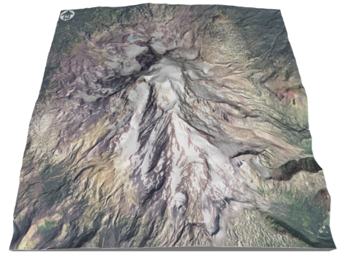
Mount Adams, known by some Native American tribes as Pahto or Klickitat, is a potentially active stratovolcano in the Cascade Range.[3] Although Adams has not erupted in more than 1,000 years, it is not considered extinct. It is the second-highest mountain in the U.S. state of Washington, after Mount Rainier.[4]
Adams is a member of the Cascade Volcanic Arc, and is one of the arc's largest volcanoes,[5] located in a remote wilderness approximately 34 miles (55 km) east of Mount St. Helens.[6] The Mount Adams Wilderness consists of the upper and western part of the volcano's cone. The eastern side of the mountain is designated as part of the territory of the Yakama Nation.[7][8]
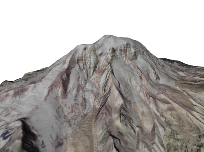
Adams' asymmetrical and broad body rises 1.5 miles (2.4 km) above the Cascade crest. Its nearly flat summit was formed as a result of cone-building eruptions from separated vents. Air travelers flying the busy routes above the area sometimes confuse Mount Adams with nearby Mount Rainier, which has a similar flat-topped shape.
The Pacific Crest Trail traverses the western flank of the mountain.
Source: Wikipedia
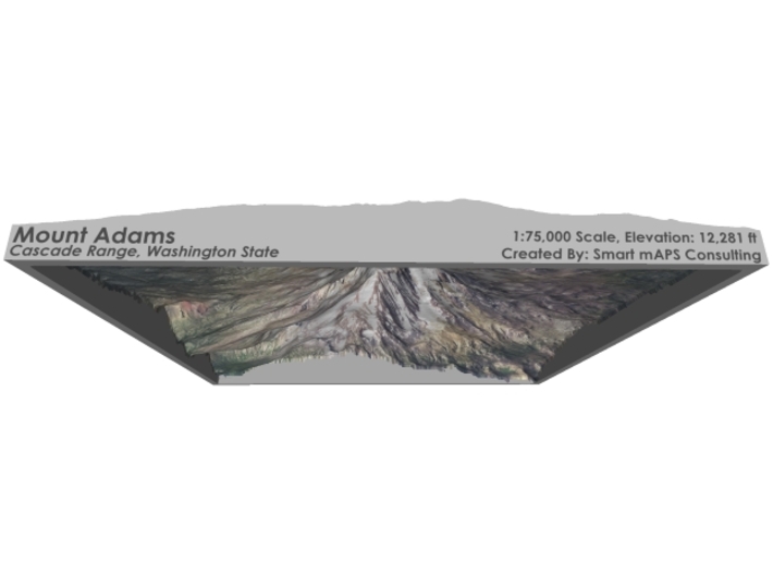
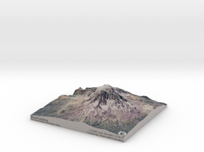
The model is created at a scale of 1:75,000 with 1.25x vertical exaggeration. It features a built-in base, so it sits perfectly on a desk or in a frame.
Model Data Sources: USDA, USGS
If you would like a custom relief map, contact me through my website or through Shapeways. Check out photos of my other 3D prints.
Mount Adams, known by some Native American tribes as Pahto or Klickitat, is a potentially active stratovolcano in the Cascade Range.[3] Although Adams has not erupted in more than 1,000 years, it is not considered extinct. It is the second-highest mountain in the U.S. state of Washington, after Mount Rainier.[4]
Adams is a member of the Cascade Volcanic Arc, and is one of the arc's largest volcanoes,[5] located in a remote wilderness approximately 34 miles (55 km) east of Mount St. Helens.[6] The Mount Adams Wilderness consists of the upper and western part of the volcano's cone. The eastern side of the mountain is designated as part of the territory of the Yakama Nation.[7][8]
Adams' asymmetrical and broad body rises 1.5 miles (2.4 km) above the Cascade crest. Its nearly flat summit was formed as a result of cone-building eruptions from separated vents. Air travelers flying the busy routes above the area sometimes confuse Mount Adams with nearby Mount Rainier, which has a similar flat-topped shape.
The Pacific Crest Trail traverses the western flank of the mountain.
Source: Wikipedia
The model is created at a scale of 1:75,000 with 1.25x vertical exaggeration. It features a built-in base, so it sits perfectly on a desk or in a frame.
Model Data Sources: USDA, USGS
Details
What's in the box:
Mt-Adams-6x6-75k

Dimensions:
Success Rate:
First To try.
What's this?
Rating:
Mature audiences only.


