Natural Full Color Sandstone

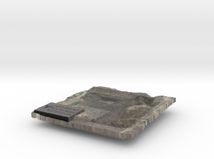
Property Map - Ground Surface
Made by
Print With Shapeways
 Choose Your Material
 Choose your color and finish
$93.66
Have a question about this product?
contact the designerYou must be logged in and verified to contact the designer.
Product Description
This is an example of a custom generated property map. This model was generated using LiDAR "bare earth" so it only includes ground elevations.
If you would like your own custom relief map, contact me through my website or through Shapeways.
Details
What's in the box:
Property Map - Ground Surface

Dimensions:
Success Rate:
First To try.
What's this?
Rating:
Mature audiences only.

More From This Shop


$206.93
$315.83