


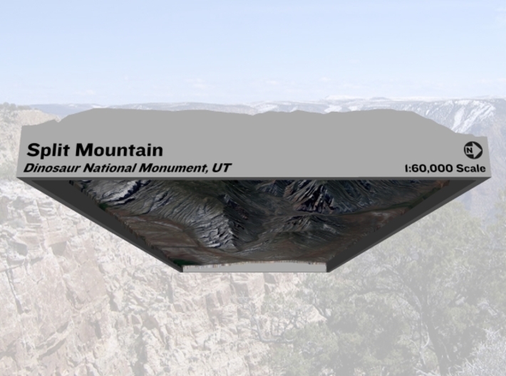


Split Mountain Map, Utah: No VE, 6"x12"
Made by
Print With Shapeways
 Choose Your Material
 Choose your color and finish
$240.13
Have a question about this product?
contact the designerYou must be logged in and verified to contact the designer.
Product Description
Interactive 3D View
If you would like a custom relief map, contact me through my website or through Shapeways. Check out photos of my other 3D prints.
Other Versions
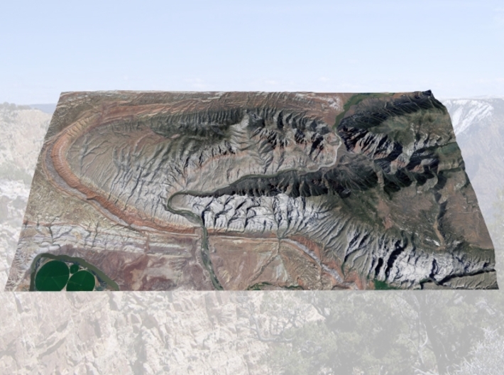
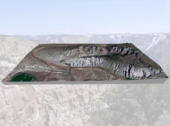
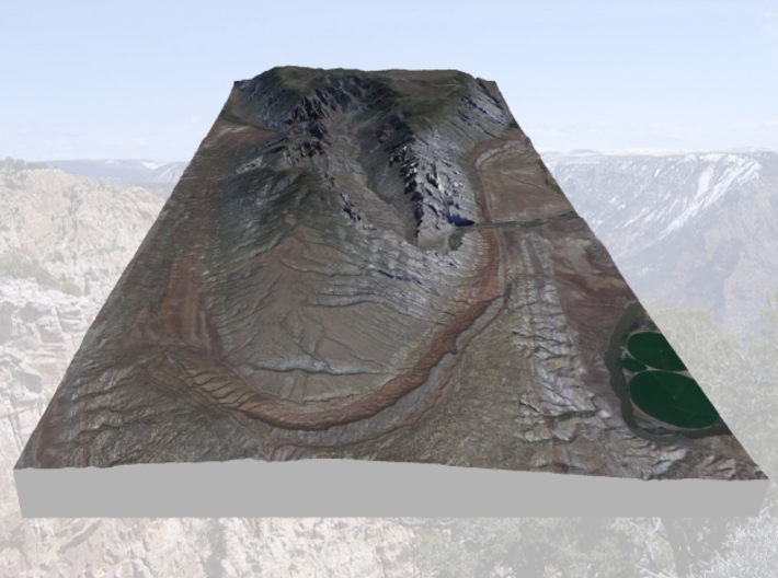
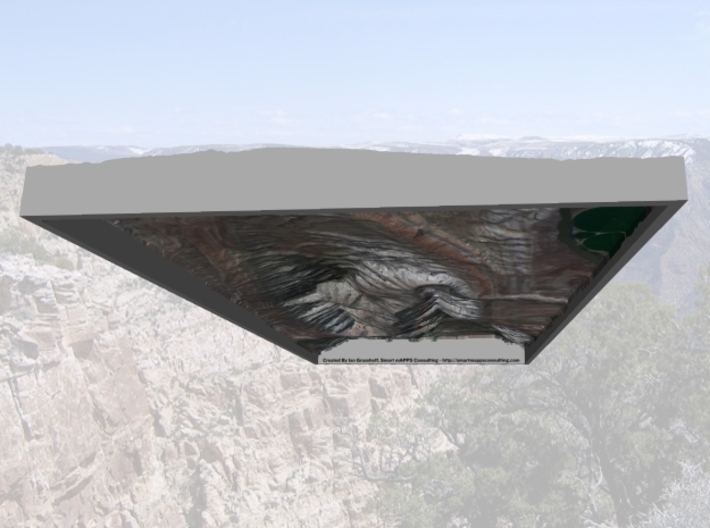
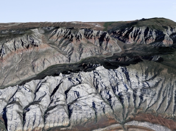
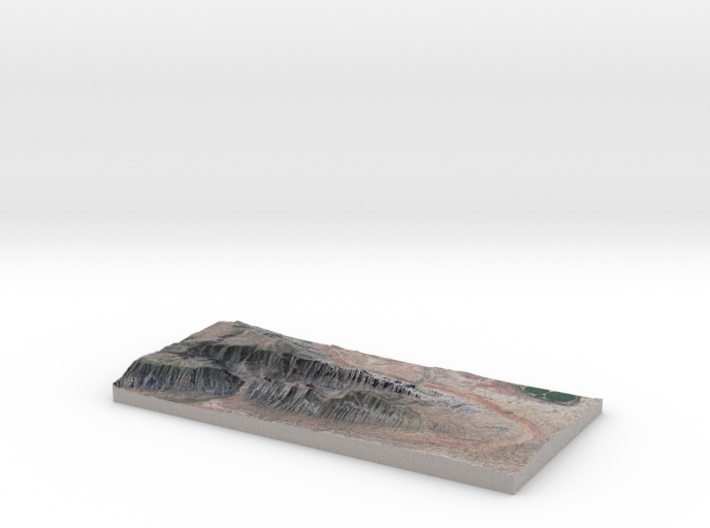
Split Mountain is near the eastern most extent of the Uinta Mountains. It gets it's name because the mountain has been "split in two" by erosion forces from the Green River. The mountain is a huge anticline, which amazingly, the Green River has cut Split Mountain Canyon right through the center and highest part of the anticline. The setting is very spectacular because the bent rock layers and geology has been exposed.
The model is created at a scale of 1:60,000 with NO vertical exaggeration. It features a built-in base, so it sits perfectly on a desk or in a frame.
Model Data Sources: State of Utah (Elevation), USDA (Imagery)
If you would like a custom relief map, contact me through my website or through Shapeways. Check out photos of my other 3D prints.
Other Versions
Split Mountain is near the eastern most extent of the Uinta Mountains. It gets it's name because the mountain has been "split in two" by erosion forces from the Green River. The mountain is a huge anticline, which amazingly, the Green River has cut Split Mountain Canyon right through the center and highest part of the anticline. The setting is very spectacular because the bent rock layers and geology has been exposed.
The model is created at a scale of 1:60,000 with NO vertical exaggeration. It features a built-in base, so it sits perfectly on a desk or in a frame.
Model Data Sources: State of Utah (Elevation), USDA (Imagery)
Request a custom order
and get this product personalized just for you
Details
What's in the box:
SplitMtn-6x12-60k-NoVe

Dimensions:
Success Rate:
First To try.
What's this?
Rating:
Mature audiences only.


