


Mount Shasta Map: 6"x6"
Made by
Print With Shapeways
 Choose Your Material
 Choose your color and finish
$153.42
Have a question about this product?
contact the designerYou must be logged in and verified to contact the designer.
Product Description
Interactive 3D View
If you would like a custom relief map, contact me through my website or through Shapeways.
Check out some photos of my other work here.
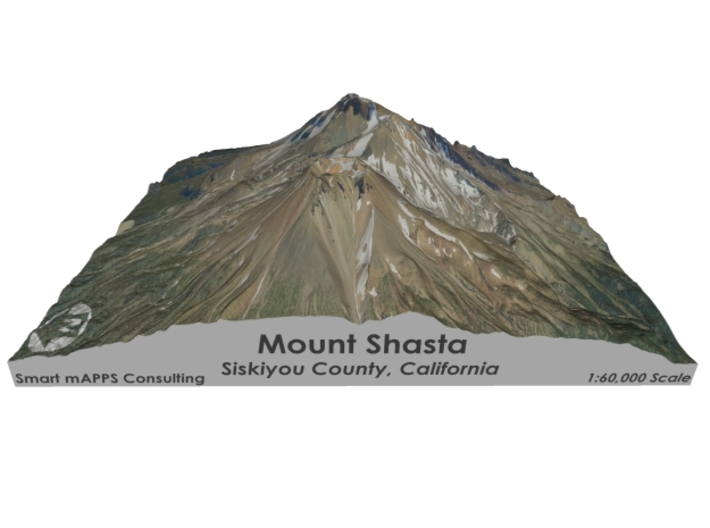
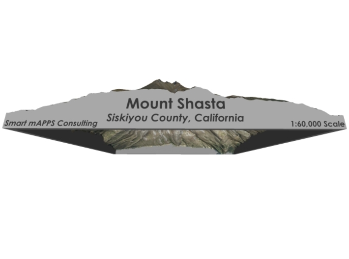
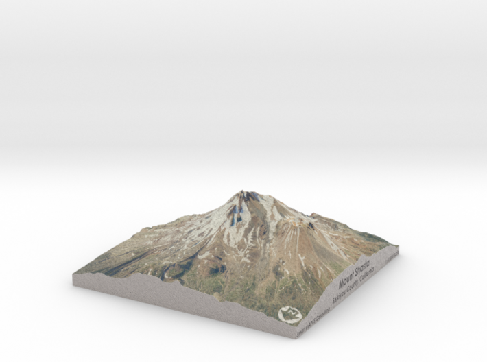
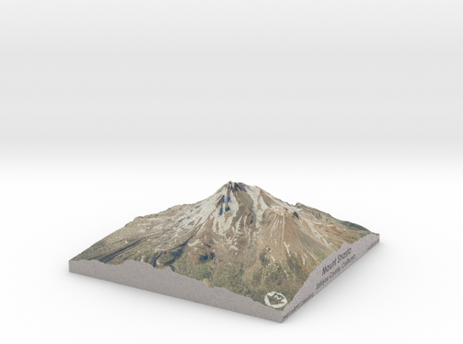
Mount Shasta (Karuk: Úytaahkoo or "White Mountain")[5][6] is a potentially active[7] volcano at the southern end of the Cascade Range in Siskiyou County, California. At an elevation of 14,179 feet (4321.8 m), it is the second-highest peak in the Cascades and the fifth-highest in the state. Mount Shasta has an estimated volume of 85 cubic miles (350 km3), which makes it the most voluminous stratovolcano in the Cascade Volcanic Arc.[8][9] The mountain and surrounding area are part of the Shasta–Trinity National Forest.
Source: Wikipedia
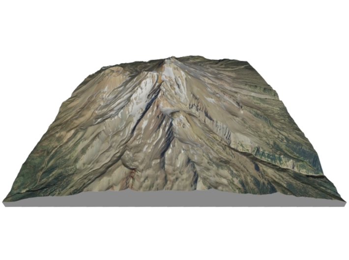
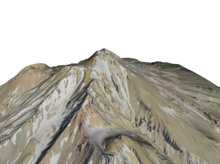
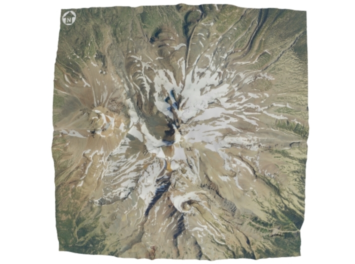
The model is created at a scale of 1:60,000 with 1.25x vertical exaggeration. It features a built-in base, so it sits perfectly on a desk or in a frame.
Model Data Sources: USDA, USGS
If you would like a custom relief map, contact me through my website or through Shapeways.
Check out some photos of my other work here.
Mount Shasta (Karuk: Úytaahkoo or "White Mountain")[5][6] is a potentially active[7] volcano at the southern end of the Cascade Range in Siskiyou County, California. At an elevation of 14,179 feet (4321.8 m), it is the second-highest peak in the Cascades and the fifth-highest in the state. Mount Shasta has an estimated volume of 85 cubic miles (350 km3), which makes it the most voluminous stratovolcano in the Cascade Volcanic Arc.[8][9] The mountain and surrounding area are part of the Shasta–Trinity National Forest.
Source: Wikipedia
The model is created at a scale of 1:60,000 with 1.25x vertical exaggeration. It features a built-in base, so it sits perfectly on a desk or in a frame.
Model Data Sources: USDA, USGS
Details
What's in the box:
Mt-Shasta-6x6-60k
Dimensions:
Success Rate:
First To try.
What's this?
Rating:
Mature audiences only.


