White Natural Versatile Plastic

Swansea and Gower W237 S183 E270 N198
Print With Shapeways
 Choose Your Material
 Choose your color and finish
$44.48
Have a question about this product?
contact the designerYou must be logged in and verified to contact the designer.
Product Description
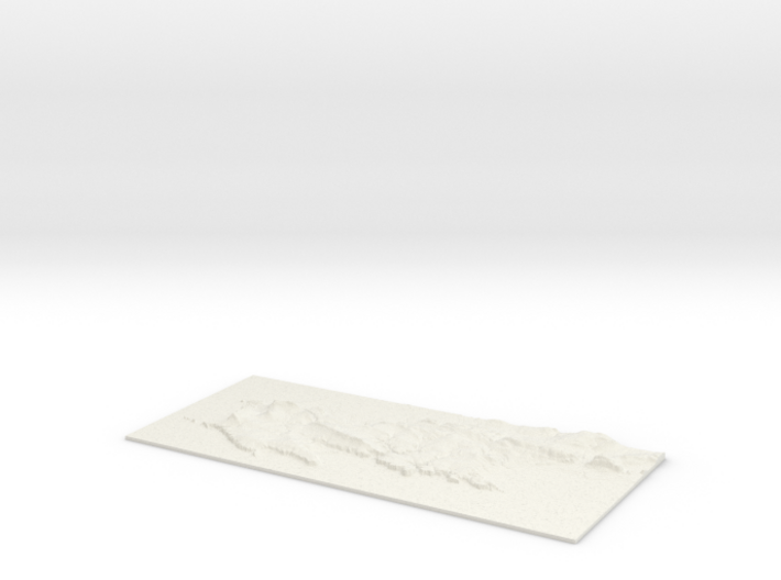
3D Landscape Relief model of the Gower Peninsula .
Centred on the towns and villages of Parkmill, Ilston, Penmaen, Nicholaston, Sandylane, Southgate, Llanmorlais, Pennard, Crofty, Kittle, Wernffrwd, Llanrhidian, Bishopston, Reynoldston, Oldwalls, Penclawdd, Northway, Penrice, Poundffald, Upper Killay, Three Crosses, Oxwich, Mayals, Burry, Knelston, Burrygreen, Black Pill, Caswell Bay, Oxwich Green, Killay, Dunvant, West Cross, Llanddewi, Landimore and Norton.
All areas of United Kingdom available in any size, scale and with any vertical scaling to emphasise the terrain to best affect.
The W S E and N numbers in the title show the Western, Southern, Eastern and Northernmost limits of the area in terms of the Ordnance Survey grid reference in kilometres.
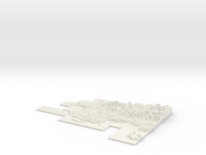
Details
What's in the box:
W237 S183 E270 N198 Swansea and Gower_fixed

Dimensions:
Success Rate:
First To try.
What's this?
Rating:
Mature audiences only.

