


Mount Rainier Map: 8"x8"
Made by
Print With Shapeways
 Choose Your Material
 Choose your color and finish
$209.63
Have a question about this product?
contact the designerYou must be logged in and verified to contact the designer.
Product Description
Interactive 3D View
If you would like a custom relief map, contact me through my website or through Shapeways.
Check out some photos of my other work here.
Other Size Options
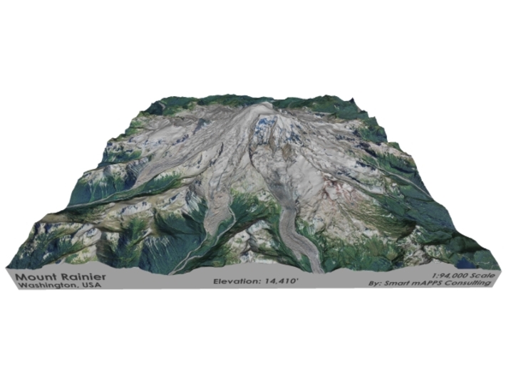
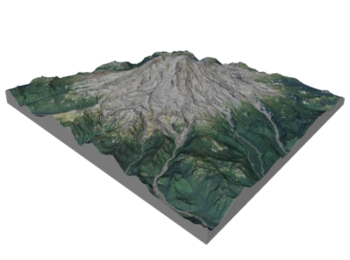
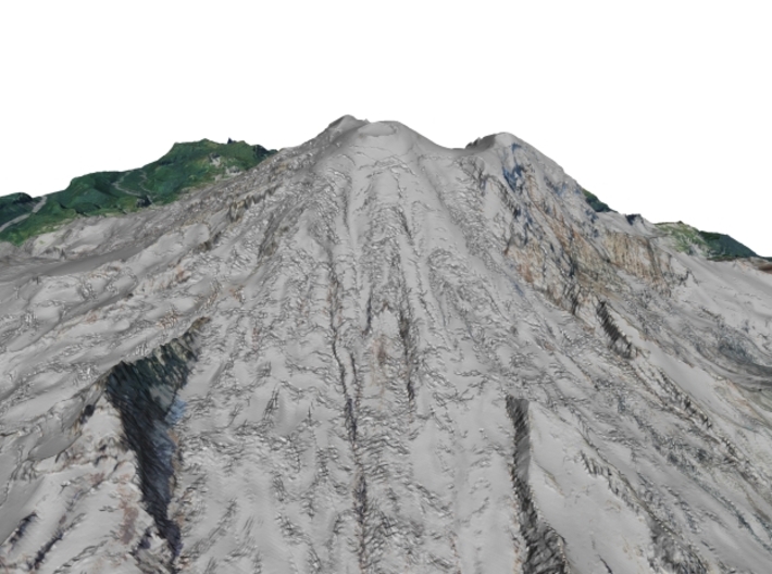
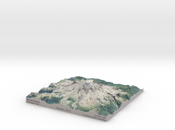
Mount Rainier (pronounced: /reɪˈnɪər/), is the highest mountain of the Cascade Range of the Pacific Northwest, and the highest mountain in the U.S. state of Washington. It is a large active stratovolcano located 54 miles (87 km) south-southeast of Seattle, in the Mount Rainier National Park. It is the most topographically prominent mountain in the contiguous United States and the Cascade Volcanic Arc, with a summit elevation of 14,411 ft (4,392 m).[4][5]
Mt. Rainier is considered one of the most dangerous volcanoes in the world, and it is on the Decade Volcano list.[6] Because of its large amount of glacial ice, Mt. Rainier could produce massive lahars that could threaten the entire Puyallup River valley, and poses a grave threat to the southern sections of the 3.7-million-resident Seattle metropolitan area.
Source: Wikipedia
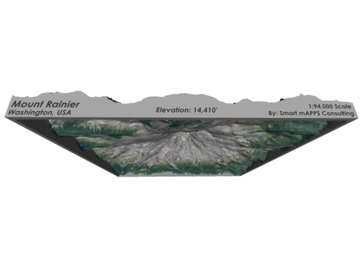
The model is created at a scale of 1:94,000 with NO vertical exaggeration. It features a built-in base, so it sits perfectly on a desk or in a frame.
Model Data Sources: USDA, USGS
If you would like a custom relief map, contact me through my website or through Shapeways.
Check out some photos of my other work here.
Other Size Options
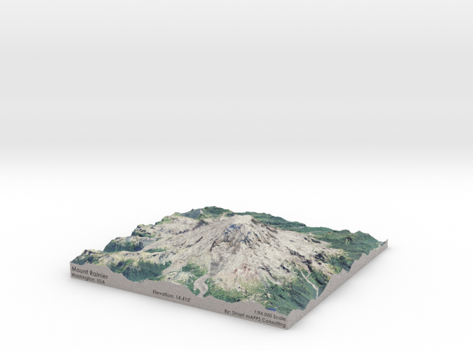
Mount Rainier (pronounced: /reɪˈnɪər/), is the highest mountain of the Cascade Range of the Pacific Northwest, and the highest mountain in the U.S. state of Washington. It is a large active stratovolcano located 54 miles (87 km) south-southeast of Seattle, in the Mount Rainier National Park. It is the most topographically prominent mountain in the contiguous United States and the Cascade Volcanic Arc, with a summit elevation of 14,411 ft (4,392 m).[4][5]
Mt. Rainier is considered one of the most dangerous volcanoes in the world, and it is on the Decade Volcano list.[6] Because of its large amount of glacial ice, Mt. Rainier could produce massive lahars that could threaten the entire Puyallup River valley, and poses a grave threat to the southern sections of the 3.7-million-resident Seattle metropolitan area.
Source: Wikipedia
The model is created at a scale of 1:94,000 with NO vertical exaggeration. It features a built-in base, so it sits perfectly on a desk or in a frame.
Model Data Sources: USDA, USGS
Details
What's in the box:
Mt-Rainier-8x8-94k
Dimensions:
Success Rate:
First To try.
What's this?
Rating:
Mature audiences only.


