


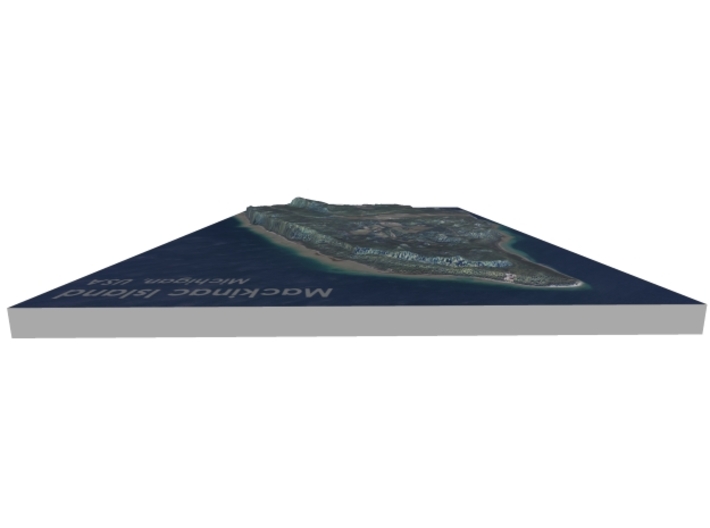

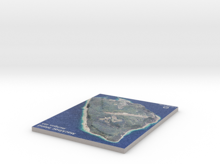
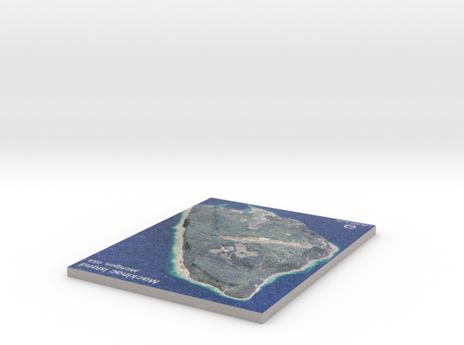
Map of Mackinac Island, Michigan
Made by
Print With Shapeways
 Choose Your Material
 Choose your color and finish
$244.40
Have a question about this product?
contact the designerYou must be logged in and verified to contact the designer.
Product Description
Interactive 3D View
If you would like a custom relief map, contact me through my website or through Shapeways.
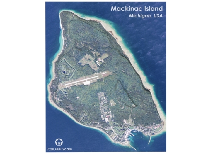
Mackinac Island (/ˈmækɪnɔː/ MAK-in-aw) is an island and resort area, covering 3.8 square miles (9.8 km2) in land area, in the U.S. state of Michigan. It is located in Lake Huron, at the eastern end of the Straits of Mackinac, between the state's Upper and Lower Peninsulas.[5] The island was home to an Odawa settlement before European exploration began in the 17th century. It served a strategic position as a center on the commerce of the Great Lakes fur trade. This led to the establishment of Fort Mackinac on the island by the British during the American Revolutionary War. It was the site of two battles during the War of 1812.[6]
In the late 19th century, Mackinac Island became a popular tourist attraction and summer colony. Much of the island has undergone extensive historical preservation and restoration; as a result, the entire island is listed as a National Historic Landmark. It is well known for its numerous cultural events; its wide variety of architectural styles, including the VictorianGrand Hotel and its ban on almost all motor vehicles. More than 80 percent of the island is preserved as Mackinac Island State Park.[7]
Source: Wikipedia
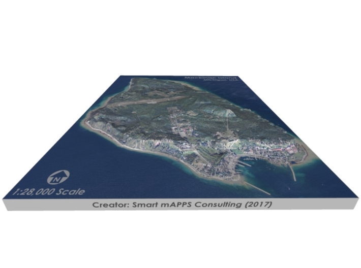
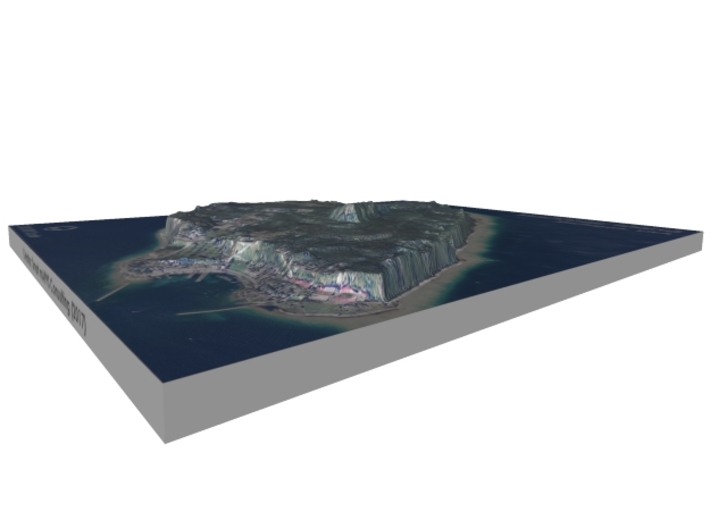
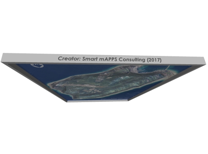
The model is created at a scale of 1:28,000 with 5x vertical exaggeration. It features a built-in base, so it sits perfectly on a desk or in a frame.
Model Data Sources: USDA, USGS
If you would like a custom relief map, contact me through my website or through Shapeways.
Mackinac Island (/ˈmækɪnɔː/ MAK-in-aw) is an island and resort area, covering 3.8 square miles (9.8 km2) in land area, in the U.S. state of Michigan. It is located in Lake Huron, at the eastern end of the Straits of Mackinac, between the state's Upper and Lower Peninsulas.[5] The island was home to an Odawa settlement before European exploration began in the 17th century. It served a strategic position as a center on the commerce of the Great Lakes fur trade. This led to the establishment of Fort Mackinac on the island by the British during the American Revolutionary War. It was the site of two battles during the War of 1812.[6]
In the late 19th century, Mackinac Island became a popular tourist attraction and summer colony. Much of the island has undergone extensive historical preservation and restoration; as a result, the entire island is listed as a National Historic Landmark. It is well known for its numerous cultural events; its wide variety of architectural styles, including the VictorianGrand Hotel and its ban on almost all motor vehicles. More than 80 percent of the island is preserved as Mackinac Island State Park.[7]
Source: Wikipedia
The model is created at a scale of 1:28,000 with 5x vertical exaggeration. It features a built-in base, so it sits perfectly on a desk or in a frame.
Model Data Sources: USDA, USGS
Details
What's in the box:
Mackinac-Island-8x10-28k
Dimensions:
Success Rate:
First To try.
What's this?
Rating:
Mature audiences only.


