


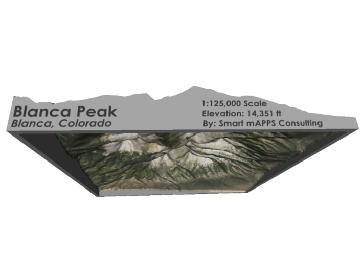


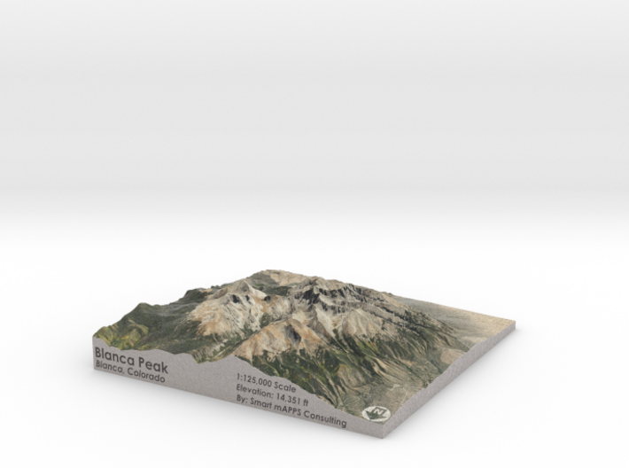
Blanca Peak Map: 6"x6"
Made by
Print With Shapeways
 Choose Your Material
 Choose your color and finish
$152.52
Have a question about this product?
contact the designerYou must be logged in and verified to contact the designer.
Product Description
Interactive 3D View
If you would like a custom relief map, contact me through my website or through Shapeways. Check out photos of my other 3D prints.
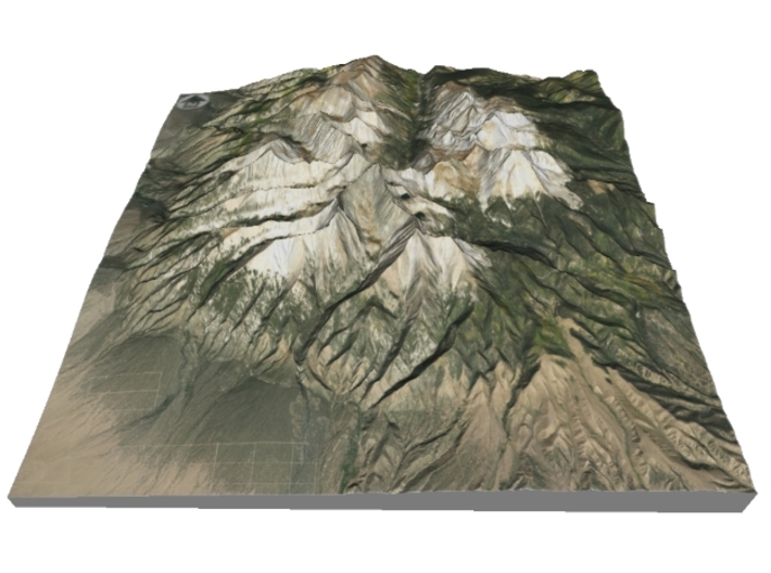
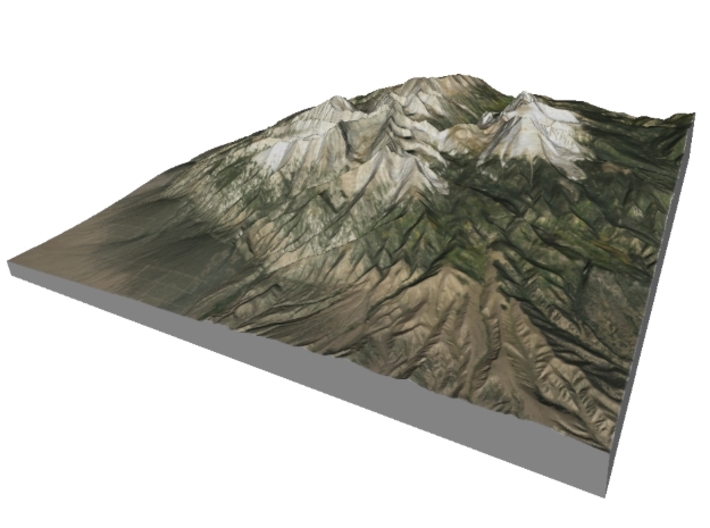
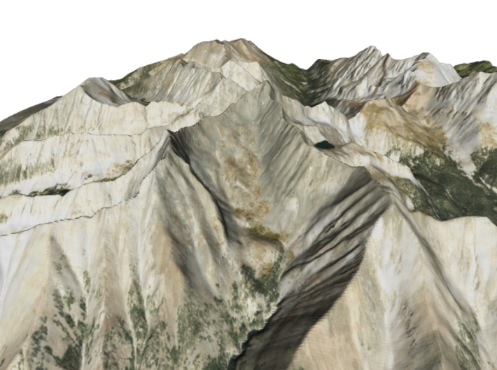
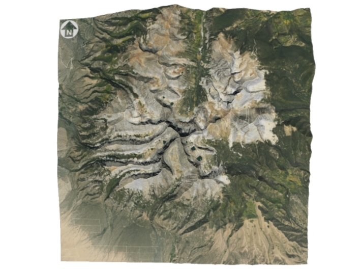
Blanca Peak is the fourth highest summit of the Rocky Mountains of North America and the U.S. state of Colorado. The ultra-prominent 14,351-foot (4,374 m) peak is the highest summit of the Sierra Blanca Massif, the Sangre de Cristo Range, and the Sangre de Cristo Mountains. The fourteener is located 9.6 miles (15.5 km) north by east (bearing 9°) of the Town of Blanca, on the drainage divide separating Rio Grande National Forest and Alamosa County from the Sangre de Cristo Land Grant and Costilla County. The summit is the highest point of both counties and the entire drainage basin of the Rio Grande. Below the steep North Face of Blanca Peak two live Glaciers once developed, and were the southernmost glaciers in the entire United States before extinction sometime after 1903. North & South Blanca Glaciers were located at 37° 35N.,longitude 105° 28W. Blanca Peak is higher than any point in the United States east of its longitude.
The Blanca Peak Tripoint of Alamosa, Costilla, and Huerfano counties is located on the same drainage divide approximately 251 feet (77 m) northeast by north (bearing 30°) of the Blanca Peak summit at the boundary of the San Isabel National Forest. The Blanca Peak Tripoint is the highest point in Huerfano County.
Soure: Wikipedia
The model is created at a scale of 1:125,000 with 1.75x vertical exaggeration. It features a built-in base, so it sits perfectly on a desk or in a frame.
Model Data Sources: USDA, USGS
If you would like a custom relief map, contact me through my website or through Shapeways. Check out photos of my other 3D prints.
Blanca Peak is the fourth highest summit of the Rocky Mountains of North America and the U.S. state of Colorado. The ultra-prominent 14,351-foot (4,374 m) peak is the highest summit of the Sierra Blanca Massif, the Sangre de Cristo Range, and the Sangre de Cristo Mountains. The fourteener is located 9.6 miles (15.5 km) north by east (bearing 9°) of the Town of Blanca, on the drainage divide separating Rio Grande National Forest and Alamosa County from the Sangre de Cristo Land Grant and Costilla County. The summit is the highest point of both counties and the entire drainage basin of the Rio Grande. Below the steep North Face of Blanca Peak two live Glaciers once developed, and were the southernmost glaciers in the entire United States before extinction sometime after 1903. North & South Blanca Glaciers were located at 37° 35N.,longitude 105° 28W. Blanca Peak is higher than any point in the United States east of its longitude.
The Blanca Peak Tripoint of Alamosa, Costilla, and Huerfano counties is located on the same drainage divide approximately 251 feet (77 m) northeast by north (bearing 30°) of the Blanca Peak summit at the boundary of the San Isabel National Forest. The Blanca Peak Tripoint is the highest point in Huerfano County.
Soure: Wikipedia
The model is created at a scale of 1:125,000 with 1.75x vertical exaggeration. It features a built-in base, so it sits perfectly on a desk or in a frame.
Model Data Sources: USDA, USGS
Details
What's in the box:
Blanca-Peak-125k-6x6

Dimensions:
Success Rate:
First To try.
What's this?
Rating:
Mature audiences only.


