


Rangitoto Island Map
Made by
Print With Shapeways
 Choose Your Material
 Choose your color and finish
$245.89
Have a question about this product?
contact the designerYou must be logged in and verified to contact the designer.
Product Description
If you would like a custom relief map, contact me through my website or through Shapeways. Check out photos of my other 3D prints.
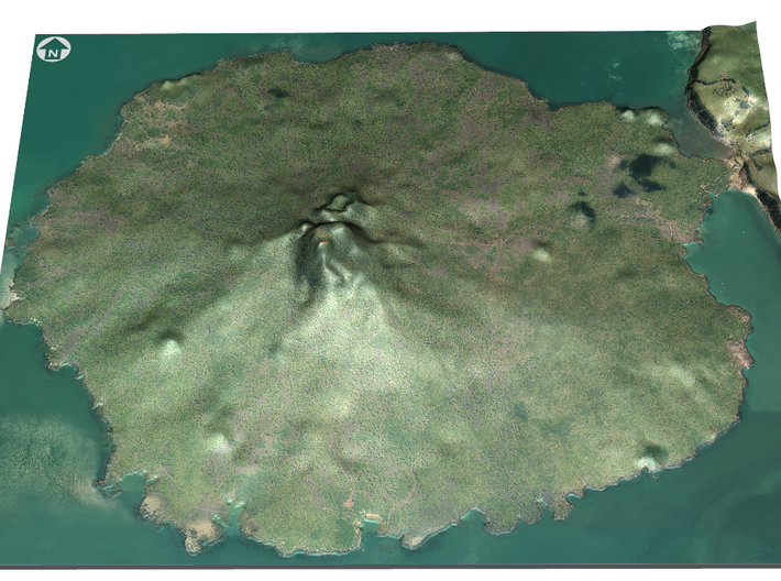
Rangitoto Island is a volcanic island in the Hauraki Gulf near Auckland, New Zealand. The 5.5 km wide island is an iconic and widely visible landmark of Auckland with its distinctive symmetrical shield volcano cone rising 260 metres (850 ft) high over the Hauraki Gulf.[1][2] Rangitoto is the most recent and the largest (2311 hectares)[3] of the approximately 50 volcanoes of the Auckland volcanic field.[2] It is separated from the mainland of Auckland's North Shore by the Rangitoto Channel. Since World War II, it has been linked by a causeway to the much older, non-volcanic Motutapu Island.[4]
Rangitoto is Māori for 'Bloody Sky',[5] with the name coming from the full phrase Ngā Rangi-i-totongia-a Tama-te-kapua ("The days of the bleeding of Tama-te-kapua"). Tama-te-kapua was the captain of the Arawa waka (canoe) and was badly wounded on the island, after having lost a battle with the Tainui iwi (tribe) at Islington Bay.
Source: Wikipedia
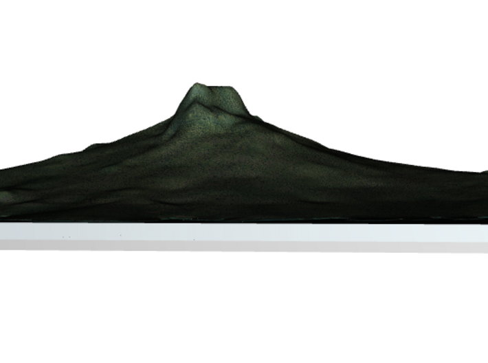
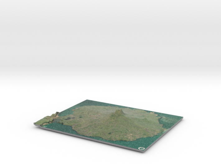
The model is created at a scale of 1:26,000 with 3x vertical exaggeration. It features a built-in base, so it sits perfectly on a desk or in a frame.
Model Data Sources: Land Information New Zealand (LINZ) and NASA.
Rangitoto Island is a volcanic island in the Hauraki Gulf near Auckland, New Zealand. The 5.5 km wide island is an iconic and widely visible landmark of Auckland with its distinctive symmetrical shield volcano cone rising 260 metres (850 ft) high over the Hauraki Gulf.[1][2] Rangitoto is the most recent and the largest (2311 hectares)[3] of the approximately 50 volcanoes of the Auckland volcanic field.[2] It is separated from the mainland of Auckland's North Shore by the Rangitoto Channel. Since World War II, it has been linked by a causeway to the much older, non-volcanic Motutapu Island.[4]
Rangitoto is Māori for 'Bloody Sky',[5] with the name coming from the full phrase Ngā Rangi-i-totongia-a Tama-te-kapua ("The days of the bleeding of Tama-te-kapua"). Tama-te-kapua was the captain of the Arawa waka (canoe) and was badly wounded on the island, after having lost a battle with the Tainui iwi (tribe) at Islington Bay.
Source: Wikipedia
The model is created at a scale of 1:26,000 with 3x vertical exaggeration. It features a built-in base, so it sits perfectly on a desk or in a frame.
Model Data Sources: Land Information New Zealand (LINZ) and NASA.
Details
What's in the box:
Rangitoto Island

Dimensions:
Success Rate:
First To try.
What's this?
Rating:
Mature audiences only.


