


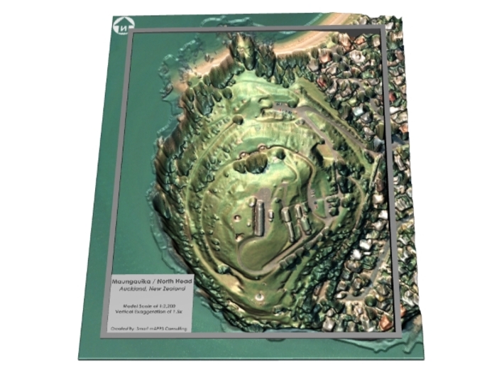

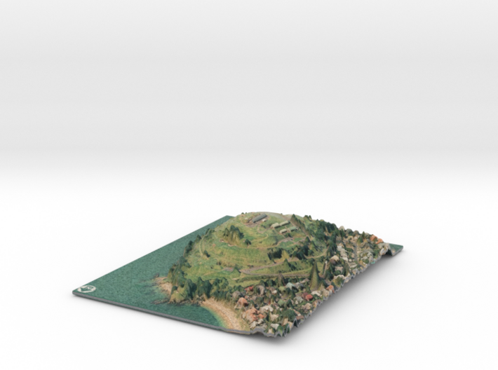
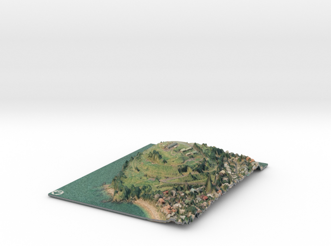
Maungauika / North Head Map
Made by
Print With Shapeways
 Choose Your Material
 Choose your color and finish
$261.57
Have a question about this product?
contact the designerYou must be logged in and verified to contact the designer.
Product Description
If you would like a custom relief map, contact me through my website or through Shapeways. Check out photos of my other 3D prints.
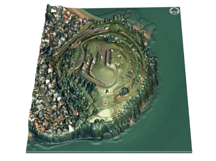
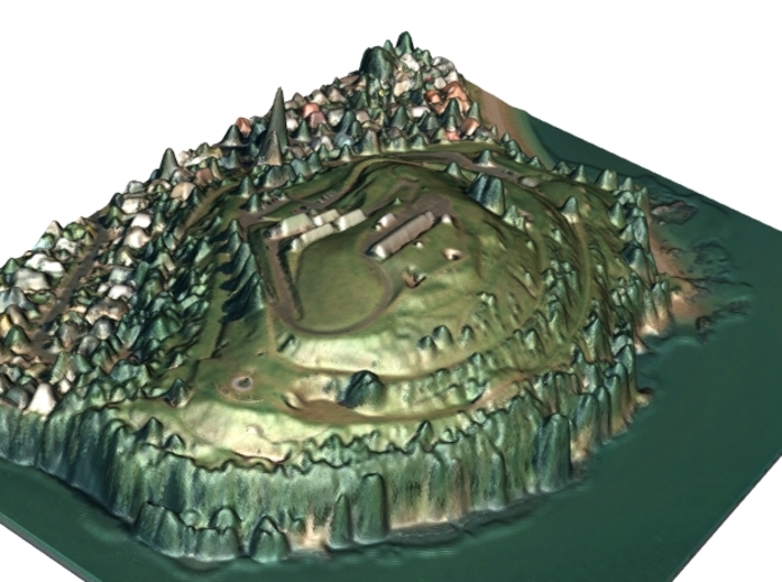
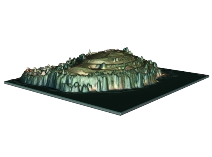
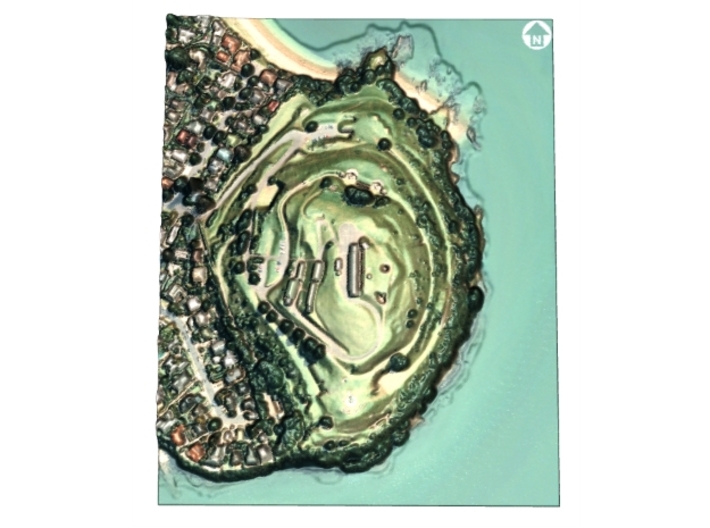
Maungauika is a volcano forming a headland called North Head at the east end of the Waitemata Harbour in Auckland, New Zealand in the suburb of Devonport. Known for its sweeping views over the harbour and the Hauraki Gulf, since 1885 the head was mainly used by the military as a coastal defence installation, which left a network of accessible old bunkers and tunnels as its legacy, forming part of the attraction. The site was protected as part of Hauraki Gulf Maritime Park in 1972 and listed as a Category I historic place in 2001. As part of a 2014 Treaty of Waitangi claim settlement the volcanic cone was officially named Maungauika and the reserve renamed Maungauika / North Head Historic Reserve. Maungauika is the Māori word for Mountain of Uika.
Source: Wikipedia
The model is created at a scale of 1:2,200 with a vertical exaggeration of 3x. It features a built-in base, so it sits perfectly on a desk or in a frame. A LiDAR derived digital surface model (DSM) was used, so you can see features like trees and buildings.
Model Data Sources: Land Information New Zealand (LINZ).
Details
What's in the box:
North Head
Dimensions:
Success Rate:
First To try.
What's this?
Rating:
Mature audiences only.


