Tan Fine Detail Plastic

Widford W560 S200 E570 N210
Print With Shapeways
 Choose Your Material
 Choose your color and finish
$98.29
Have a question about this product?
contact the designerYou must be logged in and verified to contact the designer.
Product Description
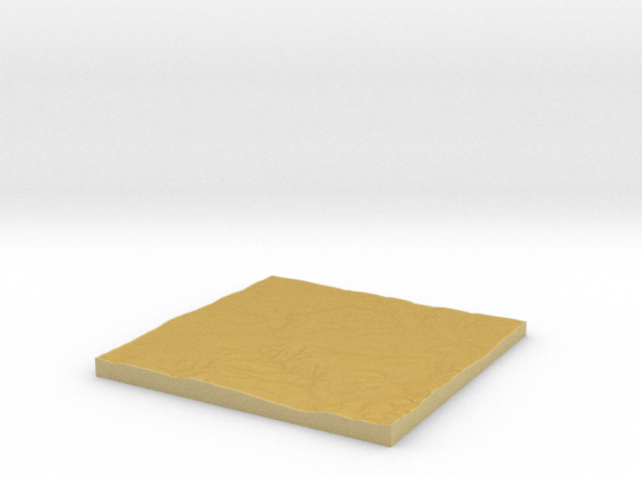
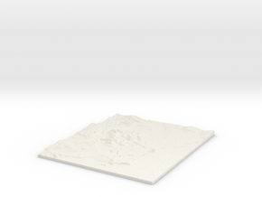
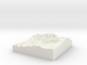
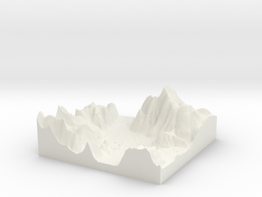
3D Terrain Relief model of Widford .
Centred on the towns and villages of Loves Green, Newney Green, Cooksmill Green, Radley Green, Great Oxney Green, Writtle, Hylands, Handley Green, Roxwell, Boyton Cross, Widford, Mill Green, Norton Heath, Margaretting, Fryerning, Shellow Bowells, Margaretting Tye and Blackmore.
All areas of United Kingdom available in any size, scale and with any vertical scaling to emphasise the terrain to best effect.
The W S E and N numbers in the title show the Western, Southern, Eastern and Northernmost limits of the area in terms of the Ordnance Survey grid reference in kilometres.
Details
What's in the box:
W560 S200 E570 N210 Loves Green

Dimensions:
Success Rate:
First To try.
What's this?
Rating:
Mature audiences only.

More From This Shop

$16.27
$31.77
$29.62