White Natural Versatile Plastic

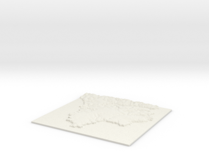
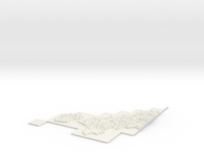
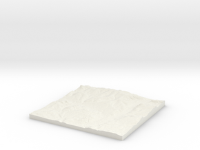
The Lizard W162 S10 E182 N29
Print With Shapeways
 Choose Your Material
 Choose your color and finish
$35.27
Have a question about this product?
contact the designerYou must be logged in and verified to contact the designer.
Product Description
3D Terrain Relief model of The Lizard area of Cornwall.
Centred on the towns and villages of Erisey, Trelan, Penhale, Gwendreath, Kuggar, Trewoon, Gwenter, Poltescoe, Traboe, Bochym, Ruan Minor, Mullion, Zoar, Cross Lanes, Trelowarren, Ruan Major, Cadgwith, St Ruan, Ponsongath, Wheel Inn, Gear, Angrouse, White Cross, Gwealeath, Newtown, Cury, St Martin`s Green, Mount Hermon, Grade, Garras, Lanarth, Mawgan, Mawgan Cross, Tregidden and Mullion Cove.
All areas of United Kingdom available in any size, scale and with any vertical scaling to emphasise the terrain to best effect.
The W S E and N numbers in the title show the Western, Southern, Eastern and Northernmost limits of the area in terms of the Ordnance Survey grid reference in kilometres.
Details
What's in the box:
W162 S10 E182 N29 The Lizard_fixed

Dimensions:
Success Rate:
First To try.
What's this?
Rating:
Mature audiences only.

More From This Shop
$33.95
$31.21