


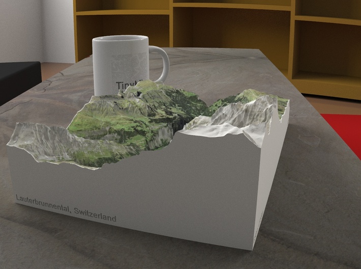


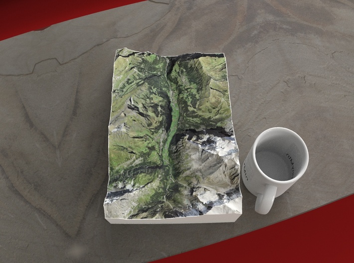

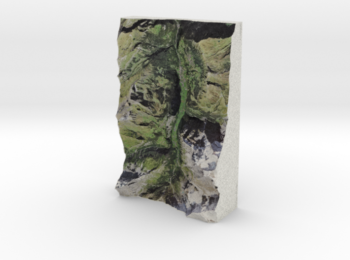
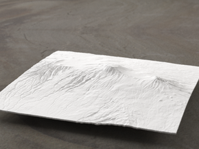
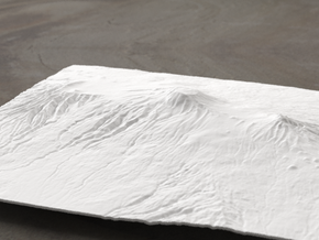
Lauterbrunnen Valley, Switzerland, 1:50000
Made by
Print With Shapeways
 Choose Your Material
 Choose your color and finish
$449.00
Have a question about this product?
contact the designerYou must be logged in and verified to contact the designer.
Product Description
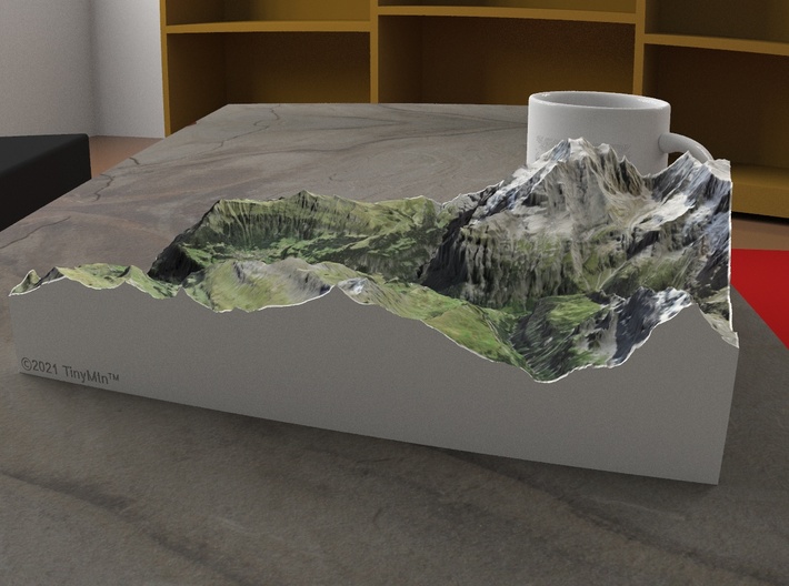
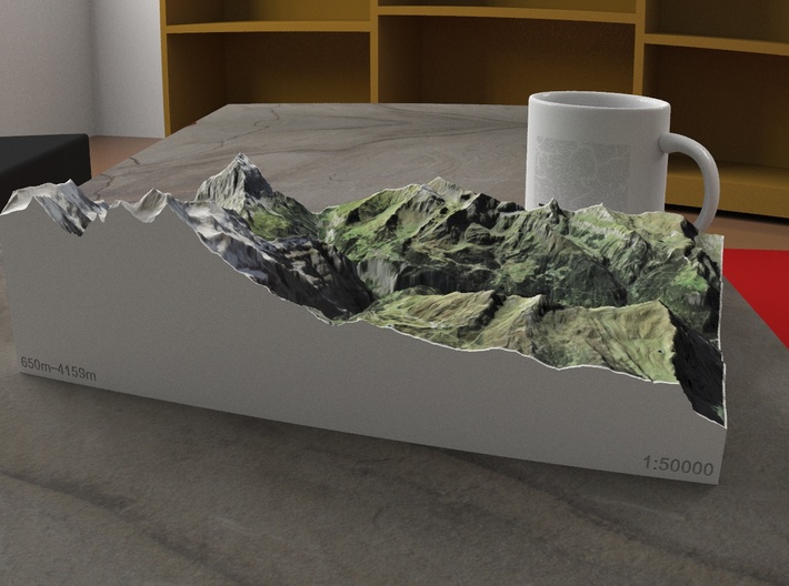
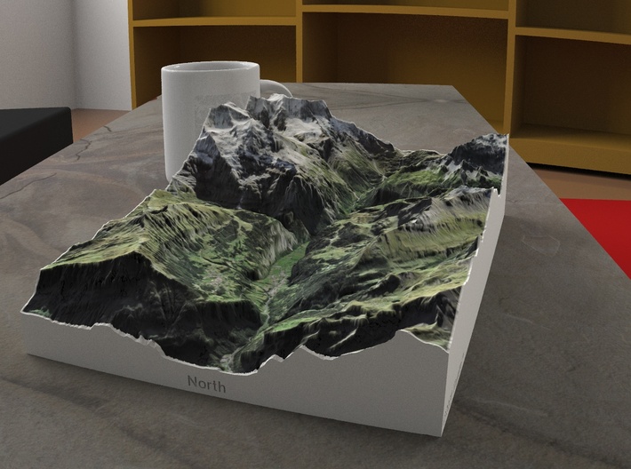
Few places in the world offer dramatic alpine peaks and quaint mountain villages like the Berner Oberland. Though the surrounding summit elevations may not seem high (the Jungfrau is 4158m, or 13,642 ft), the valleys are remarkably low (Lauterbrunnen is 802m, or 2631') -- this makes the scenery some of the most dramatic on Earth. This 3D printed model focuses on the Lauterbrunnen valley and surrounding ridges, including Jungfrau (4158m), Birg (2677m), Bietenhorn (2756m), the central highland with Männlichen (2343m), Tschuggen (2521m), and Kleine Scheidegg (2061m).
Model scale is 1:50000
Model measures 18.7 x 28 x 8.2 cm (7.4" x 11.2" x 3.2")
Original area is approximately 9.3 by 14.2 km
Altitudes covered: 650m to 4159m
There is no vertical exaggeration applied to this model. This is a true-to-life scale model of a real place.
Click here for more sizes.
Click here for other 1:50000 models.
TinyMtn models are most affordable in the "Sandstone" and "White Natural Versatile Plastic" materials. This model is in "Sandstone," which is a glued gypsum material. When you receive the model it will be ready for display, though it may smell funny and need some time to air out. "Sandstone" models are much more brittle than "Versatile Plastic" models, but feel more like light stone. Do not soak it in water, though you can safely seal it with Polycrylic or a similar water-based clear spray sealant. Read more about this popular material here.
All TinyMtn models have hollow bottoms - this is to save on weight, and thus cost. Many larger models also have extra flanges on their undersides to increase rigidity and strength. To make the model more solid, you should feel free to carefully pour resin into the bottom cavity, or glue a properly-sized slab of wood or another material into it.
These models have been optimized for the above materials, and are not offered in other materials for strength or cost reasons. If you need one in another material, please tinymtnbiz@gmail.com and we'll do our best to fulfill your request.
(C) 2021 TinyMtn (TM)
Model created using GDAL, NetPBM, Gmsh, Carve, MeshLab, and other custom software
Data source: Federal Office of Topography swisstopo
Request a custom order
and get this product personalized just for you
Details
What's in the box:
Lauterbrunnen Valley, Switzerland, 1:50000

Dimensions:
Success Rate:
First To try.
What's this?
Rating:
Mature audiences only.
