


Grand Teton Map, Wyoming (8 in)
Made by
Print With Shapeways
 Choose Your Material
 Choose your color and finish
$340.12
Have a question about this product?
contact the designerYou must be logged in and verified to contact the designer.
Product Description
Interactive 3D Viewer
If you would like a custom relief map, contact me through my website or through Shapeways. Check out photos of my other 3D prints.
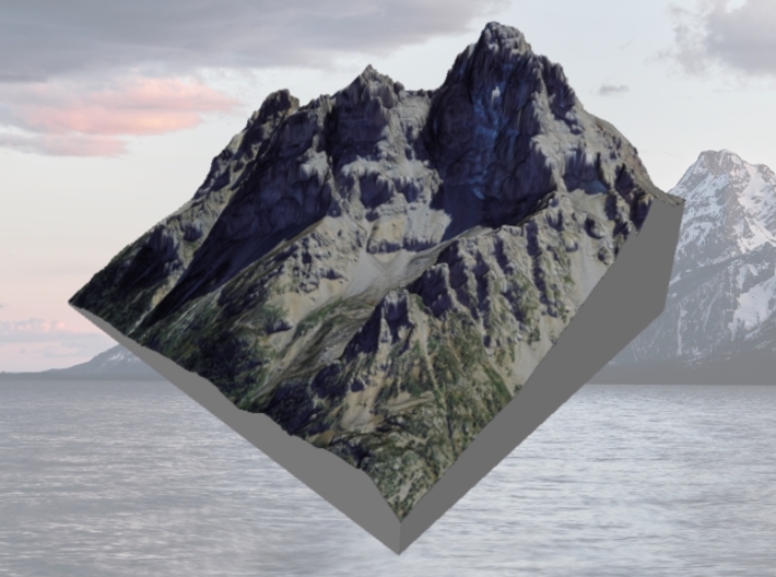
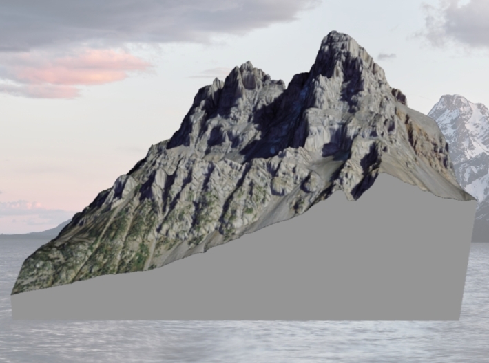
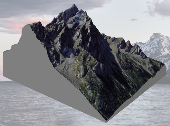
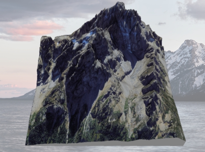
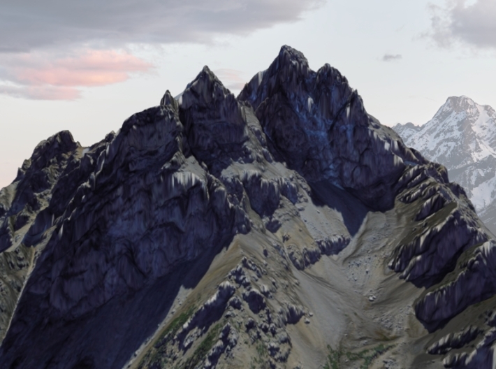
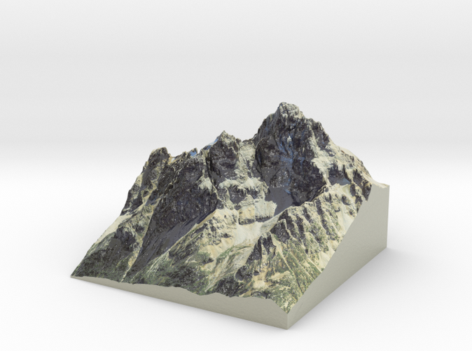
Grand Teton, at 13,775 feet (4,199 m),[2] is the highest point of the Teton Range, and the second highest peak in the U.S. state of Wyoming after Gannett Peak. The mountain is entirely within the Snake River drainage basin, which it feeds by several local creeks and glaciers.[3] The Teton Range is a subrange of the Rocky Mountains, which extend from southern Alaska to northern New Mexico.
Grand Teton's name was first recorded as Mount Hayden by the Washburn-Langford-Doane Expedition of 1870. However, the name "the Grand Teton" had early currency. The Edition of April, 1901 of the USGS 1:125,000 quadrangle map of the area shows "Grand Teton" as the name of the peak. A United States National Park named "Grand Teton National Park" was established by law in 1929. By 1931, the name Grand Teton Peak was in such common usage that it was recognized by the USGS Board on Geographic Names. Another shift in usage led the Board to shorten the name on maps to Grand Teton in 1970.[4]The origin of the name is disputed. The most common explanation is that "Grand Teton" means "large teat" in French, named by either French-Canadian or Iroquois members of an expedition led by Donald McKenzie of the North West Company.[5] However, other historians disagree, and claim that the mountain was named after the Teton Sioux tribe of Native Americans.[6]
Source: Wikipedia
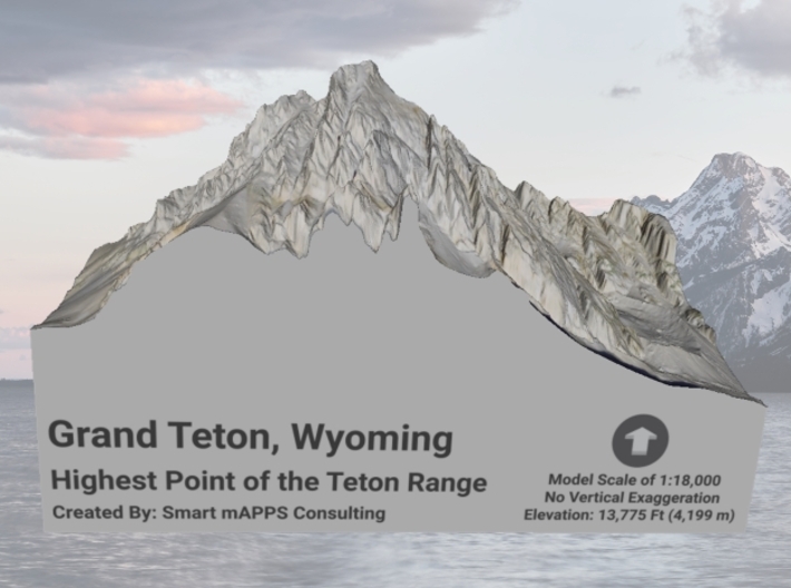
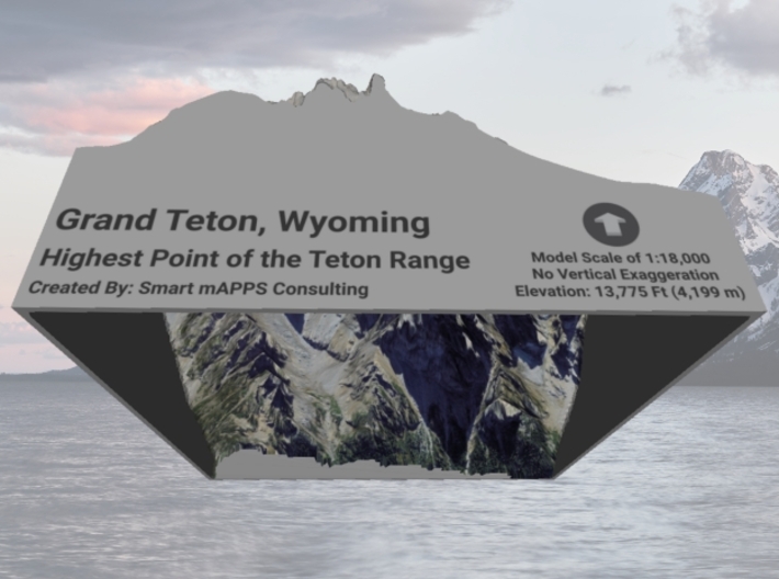
This model is created at a scale of 1:18,000 without any vertical exaggeration applied. It features a built-in base, so it sits perfectly on a desk or in a frame.
Model Data Sources: USGS, FSA
If you would like a custom relief map, contact me through my website or through Shapeways. Check out photos of my other 3D prints.
Grand Teton, at 13,775 feet (4,199 m),[2] is the highest point of the Teton Range, and the second highest peak in the U.S. state of Wyoming after Gannett Peak. The mountain is entirely within the Snake River drainage basin, which it feeds by several local creeks and glaciers.[3] The Teton Range is a subrange of the Rocky Mountains, which extend from southern Alaska to northern New Mexico.
Grand Teton's name was first recorded as Mount Hayden by the Washburn-Langford-Doane Expedition of 1870. However, the name "the Grand Teton" had early currency. The Edition of April, 1901 of the USGS 1:125,000 quadrangle map of the area shows "Grand Teton" as the name of the peak. A United States National Park named "Grand Teton National Park" was established by law in 1929. By 1931, the name Grand Teton Peak was in such common usage that it was recognized by the USGS Board on Geographic Names. Another shift in usage led the Board to shorten the name on maps to Grand Teton in 1970.[4]The origin of the name is disputed. The most common explanation is that "Grand Teton" means "large teat" in French, named by either French-Canadian or Iroquois members of an expedition led by Donald McKenzie of the North West Company.[5] However, other historians disagree, and claim that the mountain was named after the Teton Sioux tribe of Native Americans.[6]
Source: Wikipedia
This model is created at a scale of 1:18,000 without any vertical exaggeration applied. It features a built-in base, so it sits perfectly on a desk or in a frame.
Model Data Sources: USGS, FSA
Details
What's in the box:
GrandTeton-8x8
Dimensions:
Success Rate:
First To try.
What's this?
Rating:
Mature audiences only.


