

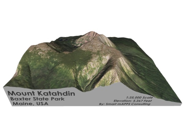


Mount Katahdin Map: 6"
Made by
Print With Shapeways
 Choose Your Material
 Choose your color and finish
$154.36
Have a question about this product?
contact the designerYou must be logged in and verified to contact the designer.
Product Description
Interactive 3D View
If you would like a custom relief map, contact me through my website or through Shapeways.
Check out some photos of my other work here.
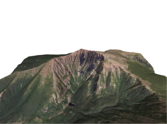
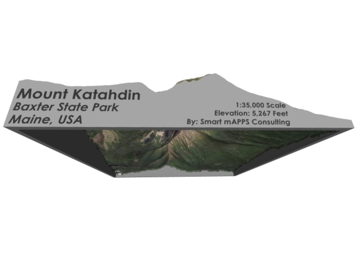
Mount Katahdin (pronounced /kəˈtɑːdən/, "kə-TAH-dən") is the highest mountain in the U.S. state of Maine at 5,267 feet (1,605 m). Named Katahdin by the Penobscot Indians, which means "The Greatest Mountain",[3] Katahdin is the centerpiece of Baxter State Park. It is a steep, tall mountain formed from a granite intrusion weathered to the surface. The flora and fauna on the mountain are typical of those found in northern New England.
Katahdin was known to the Native Americans in the region, and was known to Europeans at least since 1689. It has inspired hikes, climbs, journal narratives, paintings, and a piano sonata.[4] The area around the peak was protected by Governor Percival Baxter starting in the 1930s. Katahdin is the northern terminus of the Appalachian Trail, and is located near a stretch known as the Hundred-Mile Wilderness.
The mountain is commonly called just "Katahdin",[5] and "Baxter Peak" and "Mount Katahdin" are used interchangeably in Google Earth and Baxter State Park in official publications.[6] The official name is "Mount Katahdin" as decided by the US Board on Geographic Names in 1893.
Source: Wikipedia
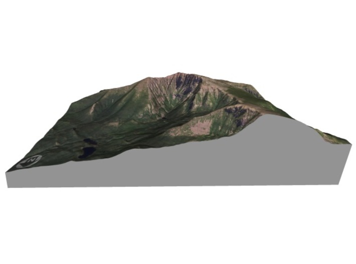
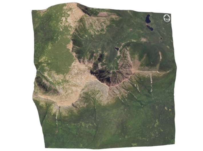
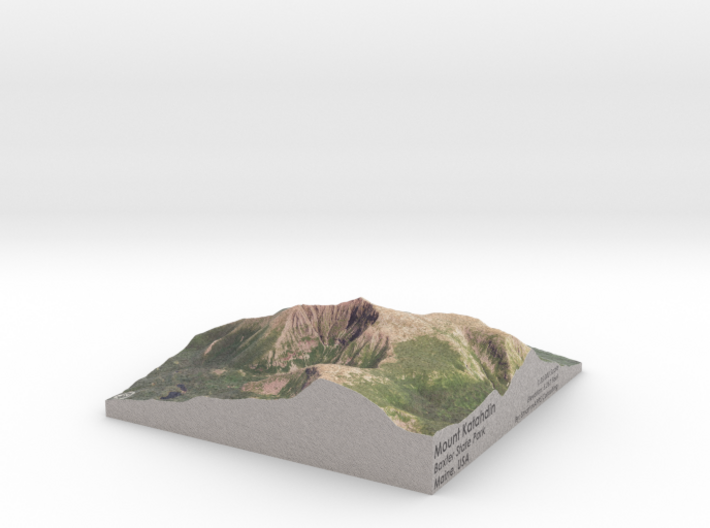
The model is created at a scale of 1:35,000 with 1.5x vertical exaggeration. It features a built-in base, so it sits perfectly on a desk or in a frame.
Model Data Sources: USDA, USGS
If you would like a custom relief map, contact me through my website or through Shapeways.
Check out some photos of my other work here.
Mount Katahdin (pronounced /kəˈtɑːdən/, "kə-TAH-dən") is the highest mountain in the U.S. state of Maine at 5,267 feet (1,605 m). Named Katahdin by the Penobscot Indians, which means "The Greatest Mountain",[3] Katahdin is the centerpiece of Baxter State Park. It is a steep, tall mountain formed from a granite intrusion weathered to the surface. The flora and fauna on the mountain are typical of those found in northern New England.
Katahdin was known to the Native Americans in the region, and was known to Europeans at least since 1689. It has inspired hikes, climbs, journal narratives, paintings, and a piano sonata.[4] The area around the peak was protected by Governor Percival Baxter starting in the 1930s. Katahdin is the northern terminus of the Appalachian Trail, and is located near a stretch known as the Hundred-Mile Wilderness.
The mountain is commonly called just "Katahdin",[5] and "Baxter Peak" and "Mount Katahdin" are used interchangeably in Google Earth and Baxter State Park in official publications.[6] The official name is "Mount Katahdin" as decided by the US Board on Geographic Names in 1893.
Source: Wikipedia
The model is created at a scale of 1:35,000 with 1.5x vertical exaggeration. It features a built-in base, so it sits perfectly on a desk or in a frame.
Model Data Sources: USDA, USGS
Details
What's in the box:
Mt-Katahdin-6x6

Dimensions:
Success Rate:
First To try.
What's this?
Rating:
Mature audiences only.


