


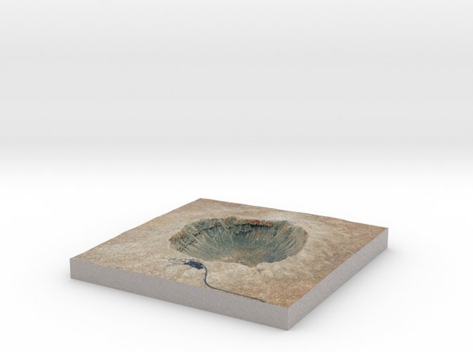
Meteor Crater Map, Arizona: 6 Inch
Made by
Print With Shapeways
 Choose Your Material
 Choose your color and finish
$115.91
Have a question about this product?
contact the designerYou must be logged in and verified to contact the designer.
Product Description
Interactive 3D View
If you would like a custom relief map, contact me through my website or through Shapeways. Check out photos of my other 3D prints.
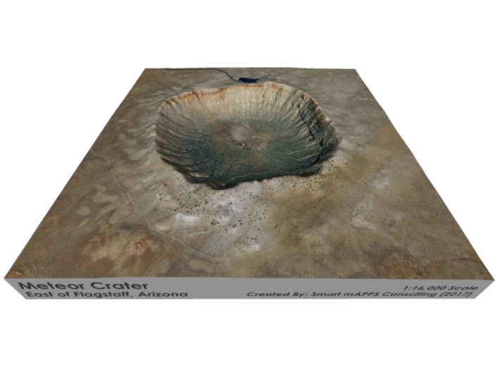
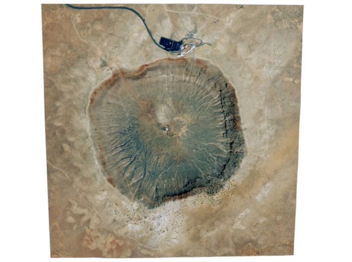
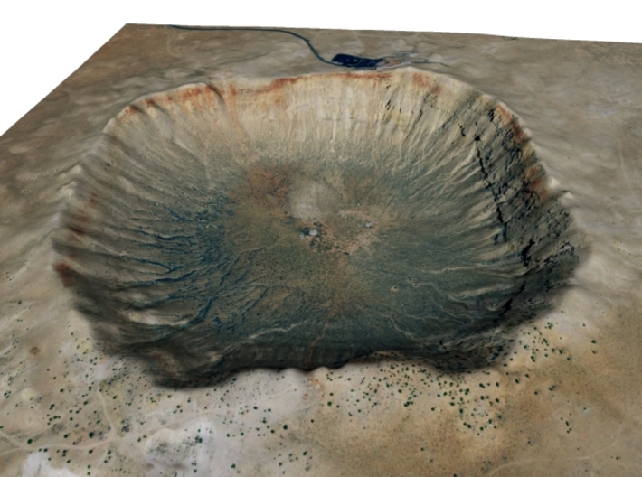
Meteor Crater is a meteorite impact crater approximately 37 miles (60 km) east of Flagstaff and 18 miles (29 km) west of Winslow in the northern Arizona desert of the United States. Because the United States Board on Geographic Namescommonly recognizes names of natural features derived from the nearest post office, the feature acquired the name of "Meteor Crater" from the nearby post office named Meteor.[2] The site was formerly known as the Canyon Diablo Craterand fragments of the meteorite are officially called the Canyon Diablo Meteorite.[3] Scientists refer to the crater as Barringer Crater in honor of Daniel Barringer, who was first to suggest that it was produced by meteorite impact.[4] The crater is privately owned by the Barringer family through their Barringer Crater Company, which proclaims it to be the "best preserved meteorite crater on Earth".[5][6]
Despite its importance as a geological site, the crater is not protected as a national monument, a status that would require federal ownership. It was designated a National Natural Landmark in November 1967.[7]
Meteor Crater lies at an elevation of about 1,740 m (5,710 ft) above sea level. It is about 1,200 m (3,900 ft) in diameter, some 170 m (560 ft) deep, and is surrounded by a rim that rises 45 m (148 ft) above the surrounding plains. The center of the crater is filled with 210–240 m (690–790 ft) of rubble lying above crater bedrock.[1] One of the interesting features of the crater is its squared-off outline, believed to be caused by existing regional jointing (cracks) in the strata at the impact site.
Source: Wikipedia
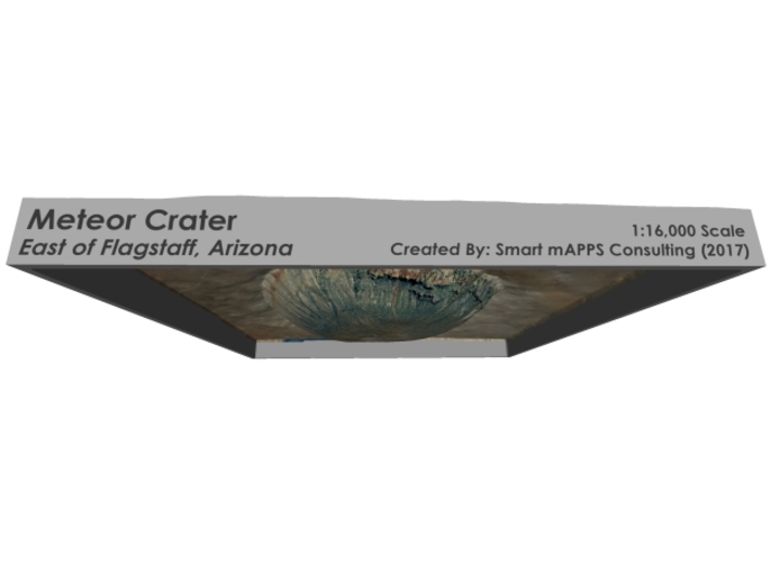
The model is created at a scale of 1:16,000 with 1.5x vertical exaggeration. It features a built-in base, so it sits perfectly on a desk or in a frame.
Model Data Sources: USDA, USGS
If you would like a custom relief map, contact me through my website or through Shapeways. Check out photos of my other 3D prints.
Meteor Crater is a meteorite impact crater approximately 37 miles (60 km) east of Flagstaff and 18 miles (29 km) west of Winslow in the northern Arizona desert of the United States. Because the United States Board on Geographic Namescommonly recognizes names of natural features derived from the nearest post office, the feature acquired the name of "Meteor Crater" from the nearby post office named Meteor.[2] The site was formerly known as the Canyon Diablo Craterand fragments of the meteorite are officially called the Canyon Diablo Meteorite.[3] Scientists refer to the crater as Barringer Crater in honor of Daniel Barringer, who was first to suggest that it was produced by meteorite impact.[4] The crater is privately owned by the Barringer family through their Barringer Crater Company, which proclaims it to be the "best preserved meteorite crater on Earth".[5][6]
Despite its importance as a geological site, the crater is not protected as a national monument, a status that would require federal ownership. It was designated a National Natural Landmark in November 1967.[7]
Meteor Crater lies at an elevation of about 1,740 m (5,710 ft) above sea level. It is about 1,200 m (3,900 ft) in diameter, some 170 m (560 ft) deep, and is surrounded by a rim that rises 45 m (148 ft) above the surrounding plains. The center of the crater is filled with 210–240 m (690–790 ft) of rubble lying above crater bedrock.[1] One of the interesting features of the crater is its squared-off outline, believed to be caused by existing regional jointing (cracks) in the strata at the impact site.
Source: Wikipedia
The model is created at a scale of 1:16,000 with 1.5x vertical exaggeration. It features a built-in base, so it sits perfectly on a desk or in a frame.
Model Data Sources: USDA, USGS
Details
What's in the box:
Meteor-Crater-6x6
Dimensions:
Success Rate:
First To try.
What's this?
Rating:
Mature audiences only.


