


Sierra Nevada Mountains Map, Spain
Made by
Print With Shapeways
 Choose Your Material
 Choose your color and finish
$247.76
Have a question about this product?
contact the designerYou must be logged in and verified to contact the designer.
Product Description
Interactive 3D View
If you would like a custom relief map, contact me through my website or through Shapeways. Check out photos of my other 3D prints.
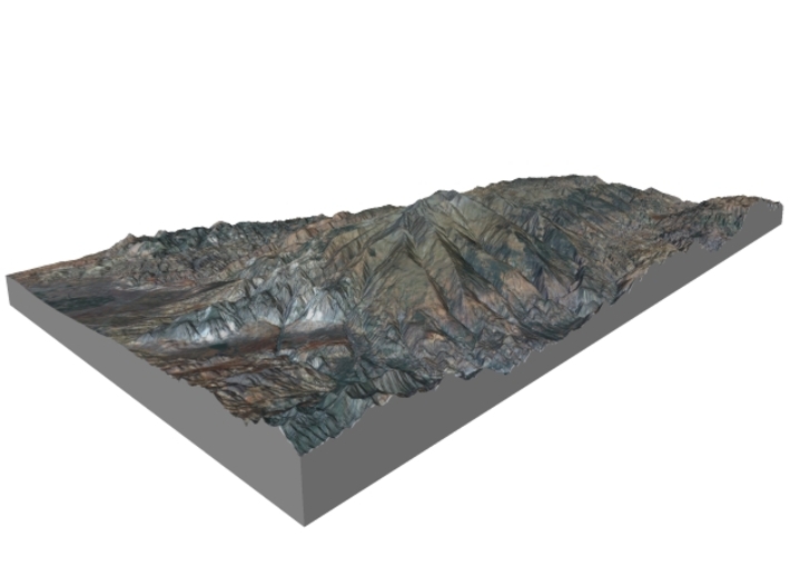
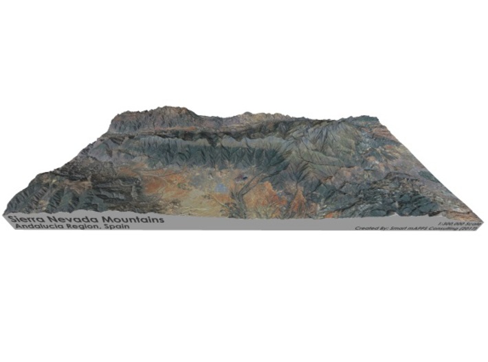
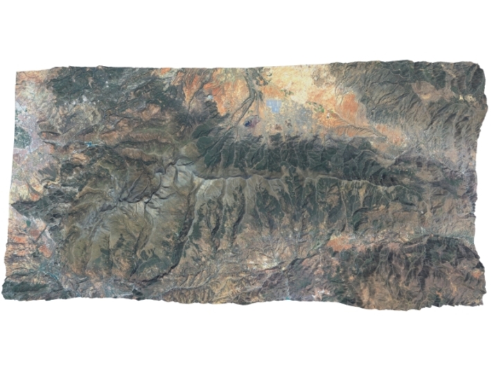
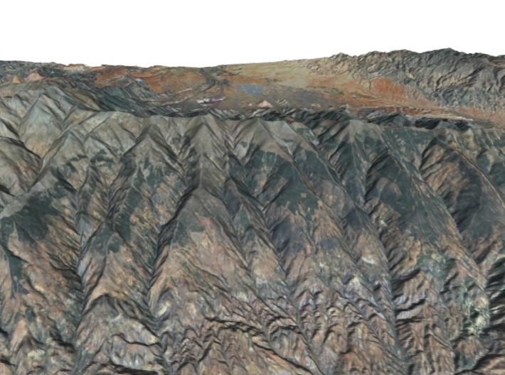
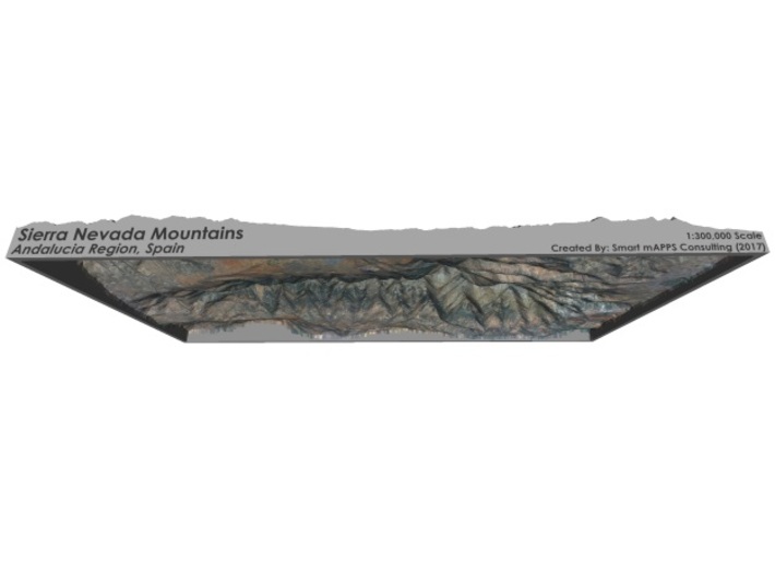
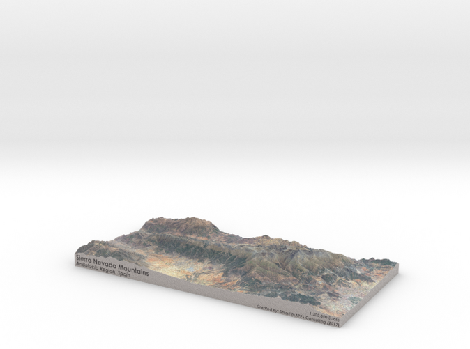
The Sierra Nevada (meaning "snowy mountain range" in Spanish) is a mountain range in the region of Andalucia, in the province of Granada and, a little further, Málaga and Almería in Spain. It contains the highest point of continental Spain and Europe[note 1] outside the Caucasus Mountains and the Alps, Mulhacén at 3,478 metres (11,411 ft) above sea level.
It is a popular tourist destination, as its high peaks make skiing possible in one of Europe's most southerly ski resorts, in an area along the Mediterranean Sea predominantly known for its warm temperatures and abundant sunshine. At its foothills is found the city of Granada and, a little further, Almería and Málaga.
Parts of the range have been included in the Sierra Nevada National Park. The range has also been declared a biosphere reserve. The Sierra Nevada Observatory and the IRAM radiotelescope are located on the northern slopes at an elevation of 2,800 metres (9,200 ft).
Source: Wikipedia
The model is created at a scale of 1:300,000 with 2.5x vertical exaggeration. It features a built-in base, so it sits perfectly on a desk or in a frame.
Model Data Sources: Instituto Geográfico Nacional (IGN) licensed under CC BY 4.0, NASA
If you would like a custom relief map, contact me through my website or through Shapeways. Check out photos of my other 3D prints.
The Sierra Nevada (meaning "snowy mountain range" in Spanish) is a mountain range in the region of Andalucia, in the province of Granada and, a little further, Málaga and Almería in Spain. It contains the highest point of continental Spain and Europe[note 1] outside the Caucasus Mountains and the Alps, Mulhacén at 3,478 metres (11,411 ft) above sea level.
It is a popular tourist destination, as its high peaks make skiing possible in one of Europe's most southerly ski resorts, in an area along the Mediterranean Sea predominantly known for its warm temperatures and abundant sunshine. At its foothills is found the city of Granada and, a little further, Almería and Málaga.
Parts of the range have been included in the Sierra Nevada National Park. The range has also been declared a biosphere reserve. The Sierra Nevada Observatory and the IRAM radiotelescope are located on the northern slopes at an elevation of 2,800 metres (9,200 ft).
Source: Wikipedia
The model is created at a scale of 1:300,000 with 2.5x vertical exaggeration. It features a built-in base, so it sits perfectly on a desk or in a frame.
Model Data Sources: Instituto Geográfico Nacional (IGN) licensed under CC BY 4.0, NASA
Details
What's in the box:
Sierra-Nevada-Spain-6x12
Dimensions:
Success Rate:
First To try.
What's this?
Rating:
Mature audiences only.


