

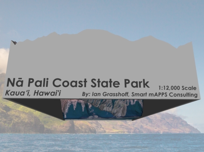


Na Pali Coast South, Hawai'i: 6"x9"
Made by
Print With Shapeways
 Choose Your Material
 Choose your color and finish
$263.09
Have a question about this product?
contact the designerYou must be logged in and verified to contact the designer.
Product Description
Interactive 3D View
If you would like a custom relief map, contact me through my website or through Shapeways. Check out photos of my other 3D prints.
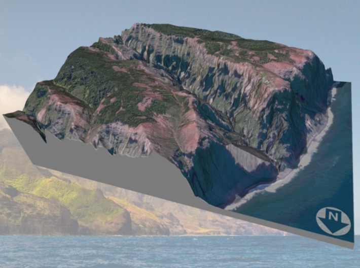
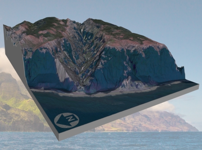
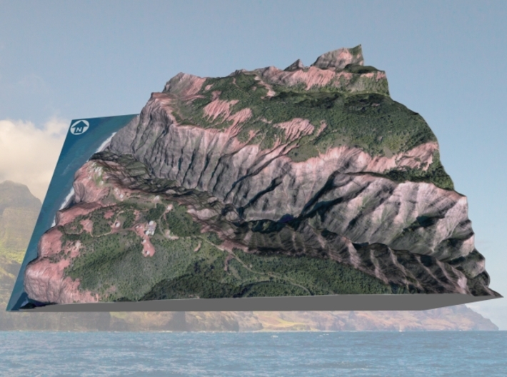
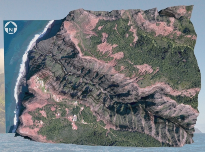
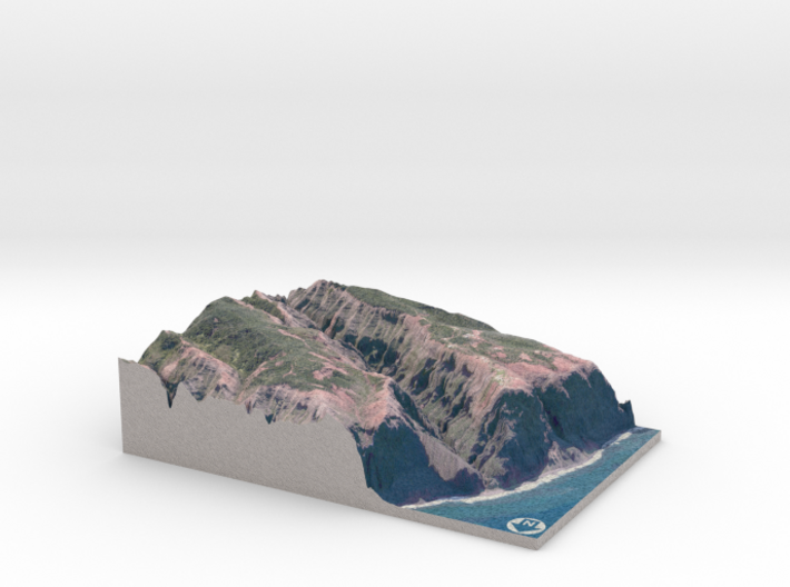
The Nā Pali Coast State Park is a 6,175 acres (2,499 ha) Hawaiian state park located in the center of the rugged 16 miles (26 km) along the northwest side of Kauaʻi, the oldest inhabited Hawaiian island. The Nā Pali coast itself extends southwest starting at Keʻe Beach extending all the way to Polihale State Park. The na pali (high cliffs) along the shoreline rise as much as 4,000 feet (1,200 m) above the Pacific Ocean. The state park was formed to protect the Kalalau Valley.
Source: Wikipedia
The model is created at a scale of 1:12,000 with NO vertical exaggeration. It features a built-in base, so it sits perfectly on a desk or in a frame.
Model Data Sources: US Dept. of Agriculture (Imagery), US Geological Survey (Elevation)
If you would like a custom relief map, contact me through my website or through Shapeways. Check out photos of my other 3D prints.
The Nā Pali Coast State Park is a 6,175 acres (2,499 ha) Hawaiian state park located in the center of the rugged 16 miles (26 km) along the northwest side of Kauaʻi, the oldest inhabited Hawaiian island. The Nā Pali coast itself extends southwest starting at Keʻe Beach extending all the way to Polihale State Park. The na pali (high cliffs) along the shoreline rise as much as 4,000 feet (1,200 m) above the Pacific Ocean. The state park was formed to protect the Kalalau Valley.
Source: Wikipedia
The model is created at a scale of 1:12,000 with NO vertical exaggeration. It features a built-in base, so it sits perfectly on a desk or in a frame.
Model Data Sources: US Dept. of Agriculture (Imagery), US Geological Survey (Elevation)
Details
What's in the box:
Na-Pali-6x9-12k-south

Dimensions:
Success Rate:
First To try.
What's this?
Rating:
Mature audiences only.


