


Newberry Volcano Map, Oregon: 8"x10"
Made by
Print With Shapeways
 Choose Your Material
 Choose your color and finish
$248.05
Have a question about this product?
contact the designerYou must be logged in and verified to contact the designer.
Product Description
Interactive 3D View
If you would like a custom relief map, contact me through my website or through Shapeways.
Check out some photos of my other work here.
Newberry Volcano (with Newberry Caldera) is a large potentially active[3] shield volcano located 40 miles (64 km) east of the Cascade Range and about 20 miles (32 km) southeast of Bend, Oregon, within the Newberry National Volcanic Monument.
It is not a typical shield volcano because, in addition to erupting basaltic lavas, it also has erupted andesitic and even rhyolitic lava.
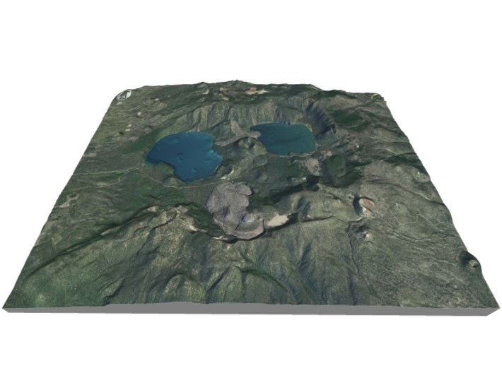
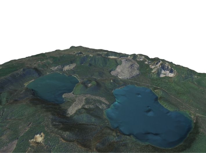
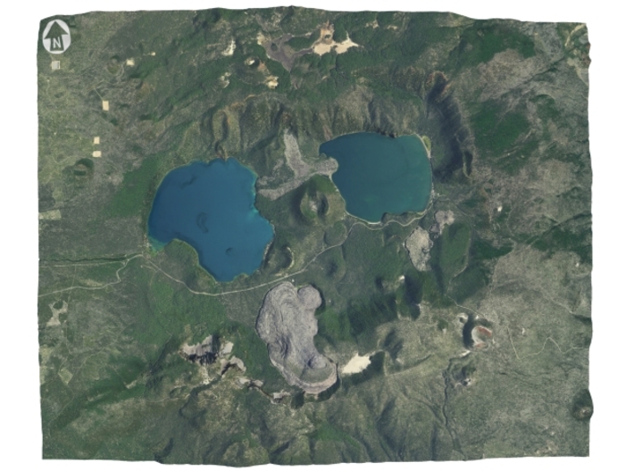
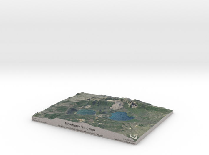
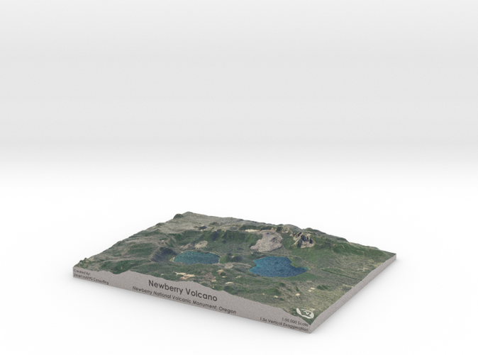
The volcano is 25 miles (40 km) in diameter and has a total volume of 120 cubic miles (500 km3).[5][6] It possesses a large oval-shaped caldera 4 by 5 miles (6.4 km × 8.0 km) in diameter, called the Newberry Caldera. Within the caldera there are two lakes (Paulina Lake and East Lake), many pyroclastic cones, lava flows, and obsidian domes.
A deep gash in the northern flank, dubbed "The Fissure", is the end of a 29-mile (47 km) long series of fractures called the Northwest Rift Zone. Approximately 6,100 years ago, basaltic lava flows erupted from the fissure and covered part of Newberry's northwest flank.
Newberry Volcano was named for John Strong Newberry, who explored central Oregon for the Pacific Railroad Surveys in 1855.
The Horse Lava Tube System, the Arnold Lava Tube System, and Lava Butte are all on the flanks of the volcano.
Source: Wikipedia
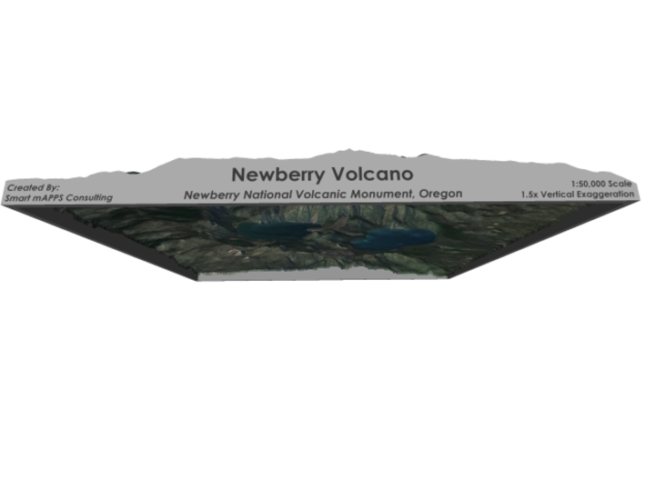
The model is created at a scale of 1:50,000 with 1.5x vertical exaggeration. It features a built-in base, so it sits perfectly on a desk or in a frame.
Model Data Sources: USDA, USGS
If you would like a custom relief map, contact me through my website or through Shapeways.
Check out some photos of my other work here.
Newberry Volcano (with Newberry Caldera) is a large potentially active[3] shield volcano located 40 miles (64 km) east of the Cascade Range and about 20 miles (32 km) southeast of Bend, Oregon, within the Newberry National Volcanic Monument.
It is not a typical shield volcano because, in addition to erupting basaltic lavas, it also has erupted andesitic and even rhyolitic lava.
The volcano is 25 miles (40 km) in diameter and has a total volume of 120 cubic miles (500 km3).[5][6] It possesses a large oval-shaped caldera 4 by 5 miles (6.4 km × 8.0 km) in diameter, called the Newberry Caldera. Within the caldera there are two lakes (Paulina Lake and East Lake), many pyroclastic cones, lava flows, and obsidian domes.
A deep gash in the northern flank, dubbed "The Fissure", is the end of a 29-mile (47 km) long series of fractures called the Northwest Rift Zone. Approximately 6,100 years ago, basaltic lava flows erupted from the fissure and covered part of Newberry's northwest flank.
Newberry Volcano was named for John Strong Newberry, who explored central Oregon for the Pacific Railroad Surveys in 1855.
The Horse Lava Tube System, the Arnold Lava Tube System, and Lava Butte are all on the flanks of the volcano.
Source: Wikipedia
The model is created at a scale of 1:50,000 with 1.5x vertical exaggeration. It features a built-in base, so it sits perfectly on a desk or in a frame.
Model Data Sources: USDA, USGS
Details
What's in the box:
Newberry-Volcano-8x10-50k
Dimensions:
Success Rate:
First To try.
What's this?
Rating:
Mature audiences only.


