


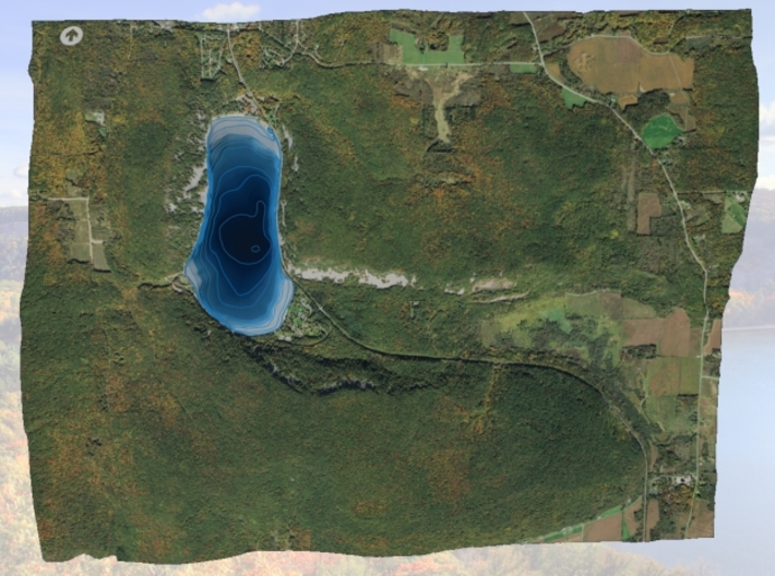


Devil's Lake Map (1:24k) - Bathymetry
Made by
Print With Shapeways
 Choose Your Material
 Choose your color and finish
$326.27
Have a question about this product?
contact the designerYou must be logged in and verified to contact the designer.
Product Description
If you would like a custom relief map, contact me through my website or through Shapeways.
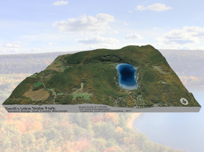
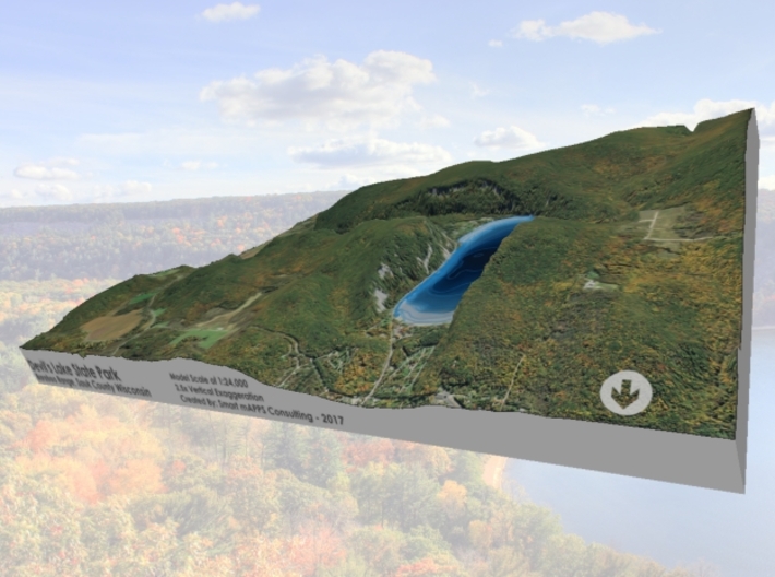
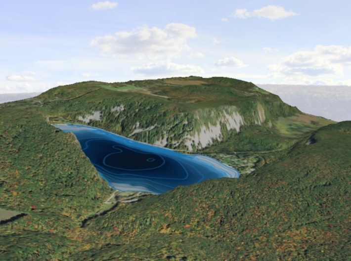
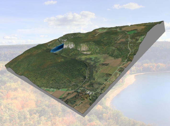
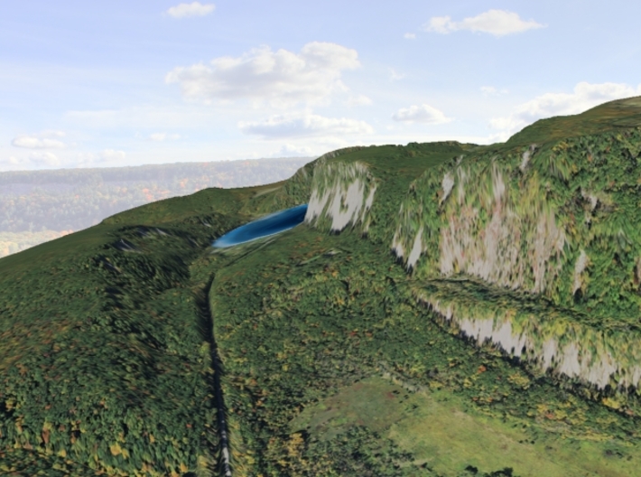
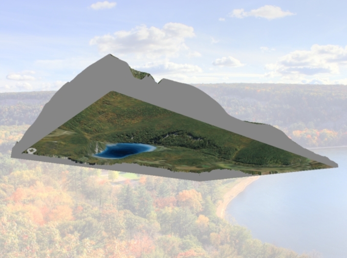
Devil's Lake State Park is a state park located in the Baraboo Range in eastern Sauk County, just south of Baraboo, Wisconsin. Devil's Lake State Park is the biggest state park in Wisconsin.[2] It is around thirty-five miles northwest of Madison, and is on the western edge of the last ice-sheet deposited during the Wisconsin drift.[3] This 9,217-acre (3,730 ha)[4] state park is known for its 500-foot-high (150 m) quartzite bluffs along the 360-acre (150 ha) Devil's Lake, which was created by a glacier depositing terminal moraines that plugged the north and south ends of the gap in the bluffs during the last ice age approximately 12,000 years ago. The sand at the bottom of Devil's Lake is thought to be deposited by glaciers. Devil's Lake is situated in the Baraboo Hills. The Baraboo Hills are thought to be much older than Devil's Lake itself; they are approximately 1.6 billion years old and were once part of the Baraboo Range which is thought to have been taller than the Rocky Mountains.
In 1974, the National Park Service declared the Southern portion of the Baraboo Hills a National Natural Landmark. The Nature Conservancy also designated it as one of the Last Great Places; it is one of only 77 of these places in the world.[2] Loess covers most of the hills and forms the parent material of a brown silt loam soil. During the autumn, the park's brilliant foliage makes it a popular attraction. The lake is surrounded by a mixed conifer-deciduous forest and the Baraboo Hills are also home to one of the largest contiguous hardwood forests in the Midwest.[2] Its scenic beauty along with its proximity to the Wisconsin Dells has made it one of the most popular of Wisconsin's state parks for both day use and overnight camping; the park receives over 1.2 million visitors annually.
Due to the long geological history of Devil's Lake and the Baraboo Range, the area has been used in geological research for years. The lake itself is rectangular in shape and is a little over a mile long from north to south and a half mile from east to west. It has many cliffs, waterfalls, unique rock formations and a variety of animal and plant species.[5] One of the most notable features of the park is the presence of large talus slopes on three sides of the lake.
Both the north and south shores have food courts and modern restroom facilities. The park has trails ranging from handicapped accessible paved trails to difficult hiking or bouldering trails. There are also designated rock climbing areas for all levels of experienced climbers. There are also bike trails available. Devil's Lake State Park contains eight miles of off-road bike trails and a two-mile paved path that is available for people with disabilities. There are three popular campgrounds at the park containing 407 campsites all together, one of which contains a sledding hill.[2] There are many quartzite rock formations, such as Balanced Rock and Devil's Doorway, throughout the park. Effigy mounds are also located throughout the park. The park contains approximately twelve miles of the 1,200-mile (1,900 km) Ice Age Trail.
Source: Wikipeida
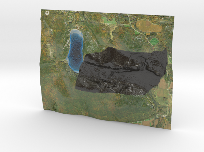
This model is created at a scale of 1:24,000 with 2.5x vertical exaggeration. It features a built-in base, so it sits perfectly on a desk or in a frame.
Model Data Sources: USDA, Sauk County Land Information
Devil's Lake State Park is a state park located in the Baraboo Range in eastern Sauk County, just south of Baraboo, Wisconsin. Devil's Lake State Park is the biggest state park in Wisconsin.[2] It is around thirty-five miles northwest of Madison, and is on the western edge of the last ice-sheet deposited during the Wisconsin drift.[3] This 9,217-acre (3,730 ha)[4] state park is known for its 500-foot-high (150 m) quartzite bluffs along the 360-acre (150 ha) Devil's Lake, which was created by a glacier depositing terminal moraines that plugged the north and south ends of the gap in the bluffs during the last ice age approximately 12,000 years ago. The sand at the bottom of Devil's Lake is thought to be deposited by glaciers. Devil's Lake is situated in the Baraboo Hills. The Baraboo Hills are thought to be much older than Devil's Lake itself; they are approximately 1.6 billion years old and were once part of the Baraboo Range which is thought to have been taller than the Rocky Mountains.
In 1974, the National Park Service declared the Southern portion of the Baraboo Hills a National Natural Landmark. The Nature Conservancy also designated it as one of the Last Great Places; it is one of only 77 of these places in the world.[2] Loess covers most of the hills and forms the parent material of a brown silt loam soil. During the autumn, the park's brilliant foliage makes it a popular attraction. The lake is surrounded by a mixed conifer-deciduous forest and the Baraboo Hills are also home to one of the largest contiguous hardwood forests in the Midwest.[2] Its scenic beauty along with its proximity to the Wisconsin Dells has made it one of the most popular of Wisconsin's state parks for both day use and overnight camping; the park receives over 1.2 million visitors annually.
Due to the long geological history of Devil's Lake and the Baraboo Range, the area has been used in geological research for years. The lake itself is rectangular in shape and is a little over a mile long from north to south and a half mile from east to west. It has many cliffs, waterfalls, unique rock formations and a variety of animal and plant species.[5] One of the most notable features of the park is the presence of large talus slopes on three sides of the lake.
Both the north and south shores have food courts and modern restroom facilities. The park has trails ranging from handicapped accessible paved trails to difficult hiking or bouldering trails. There are also designated rock climbing areas for all levels of experienced climbers. There are also bike trails available. Devil's Lake State Park contains eight miles of off-road bike trails and a two-mile paved path that is available for people with disabilities. There are three popular campgrounds at the park containing 407 campsites all together, one of which contains a sledding hill.[2] There are many quartzite rock formations, such as Balanced Rock and Devil's Doorway, throughout the park. Effigy mounds are also located throughout the park. The park contains approximately twelve miles of the 1,200-mile (1,900 km) Ice Age Trail.
Source: Wikipeida
This model is created at a scale of 1:24,000 with 2.5x vertical exaggeration. It features a built-in base, so it sits perfectly on a desk or in a frame.
Model Data Sources: USDA, Sauk County Land Information
Details
What's in the box:
DevilsLake24k

Dimensions:
Success Rate:
First To try.
What's this?
Rating:
Mature audiences only.


