


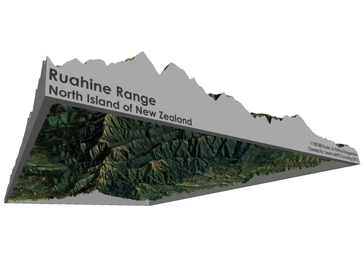

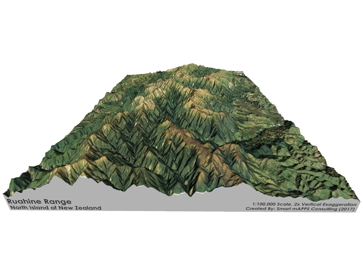


Ruahine Range Map: 8.5"x11" (100k)
Made by
Print With Shapeways
 Choose Your Material
 Choose your color and finish
$375.59
Have a question about this product?
contact the designerYou must be logged in and verified to contact the designer.
Product Description
Interactive 3D View
If you would like a custom relief map, contact me through my website or through Shapeways. Check out photos of my other 3D prints.
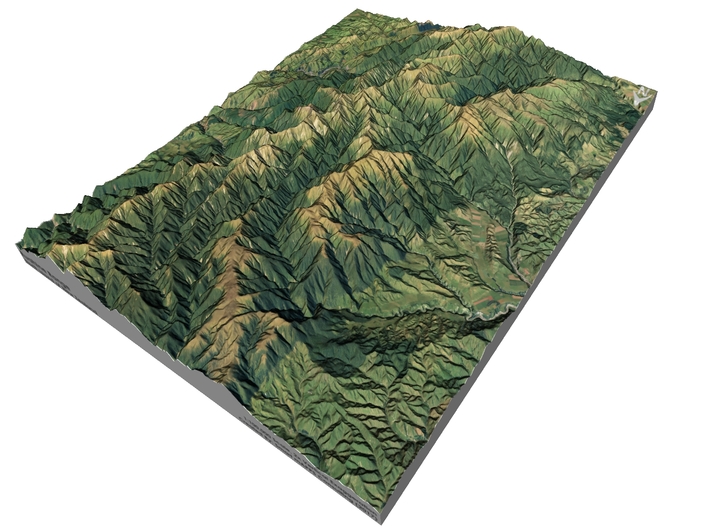
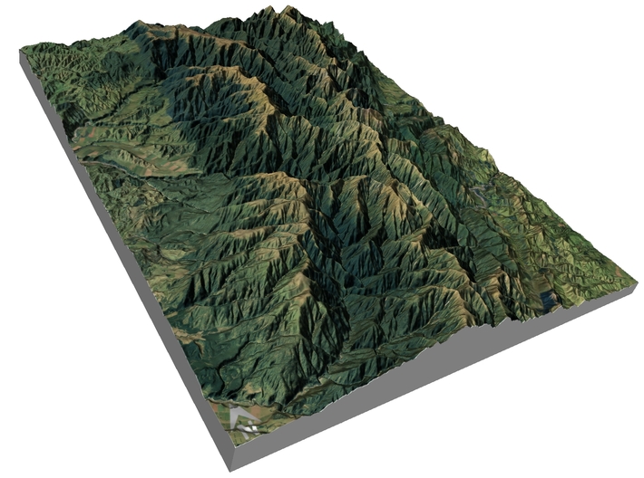
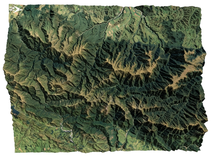
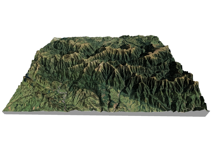
The Ruahine Range is the largest of several mountain ranges in the North Island of New Zealand that form a ridge running parallel with the east coast of the island between East Cape and Wellington. The ridge is at its most pronounced from the central North Island down to Wellington, where it comprises the Ruahine, Tararua and Rimutaka Ranges.
The Ruahines run northeast-southwest for 110 kilometres from inland Hawke's Bay to near Woodville. It is separated in the south from the northern end of the Tararua Range by the Manawatu Gorge.
The highest point in the Ruahines is Mangaweka, situated along the Hikurangi Range, which at 1733 metres (5686 feet) is the second highest non-volcanic mountainous peak in the North Island after Mt Hikurangi (1754 metres/5755 feet) in the Raukumara Range.
The other notable peak is Whariti (920 metres/3017 feet), which visually marks the southern end-point of the Ruahine Range. The dominant geographical landmark in the Manawatu and Southern Hawkes Bay districts, Whariti is perhaps better known in the region for its highly visible television transmission tower, which for a number of decades has rebroadcast national television services to the region.
Source: Wikipedia
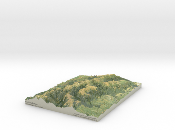
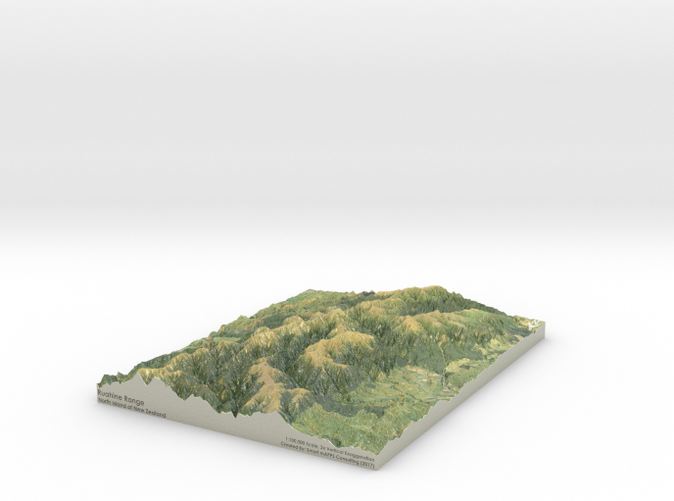
The model is created at a scale of 1:100,000 with 2x vertical exaggeration. It features a built-in base, so it sits perfectly on a desk or in a frame.
Model Data Sources: LINZ (Land Information New Zealand)
If you would like a custom relief map, contact me through my website or through Shapeways. Check out photos of my other 3D prints.
The Ruahine Range is the largest of several mountain ranges in the North Island of New Zealand that form a ridge running parallel with the east coast of the island between East Cape and Wellington. The ridge is at its most pronounced from the central North Island down to Wellington, where it comprises the Ruahine, Tararua and Rimutaka Ranges.
The Ruahines run northeast-southwest for 110 kilometres from inland Hawke's Bay to near Woodville. It is separated in the south from the northern end of the Tararua Range by the Manawatu Gorge.
The highest point in the Ruahines is Mangaweka, situated along the Hikurangi Range, which at 1733 metres (5686 feet) is the second highest non-volcanic mountainous peak in the North Island after Mt Hikurangi (1754 metres/5755 feet) in the Raukumara Range.
The other notable peak is Whariti (920 metres/3017 feet), which visually marks the southern end-point of the Ruahine Range. The dominant geographical landmark in the Manawatu and Southern Hawkes Bay districts, Whariti is perhaps better known in the region for its highly visible television transmission tower, which for a number of decades has rebroadcast national television services to the region.
Source: Wikipedia
The model is created at a scale of 1:100,000 with 2x vertical exaggeration. It features a built-in base, so it sits perfectly on a desk or in a frame.
Model Data Sources: LINZ (Land Information New Zealand)
Details
What's in the box:
Ruahine-Range-8.5x11-100k
Dimensions:
Success Rate:
First To try.
What's this?
Rating:
Mature audiences only.


