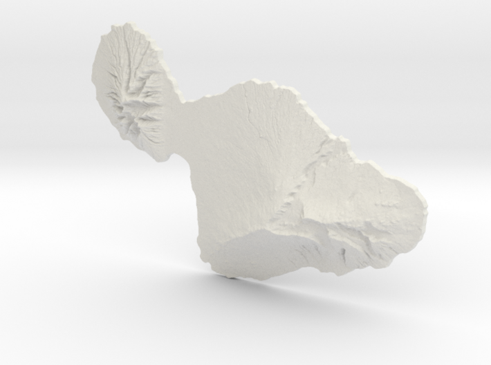

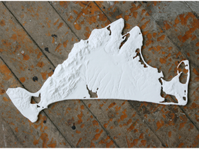
Maui, 1:500000, Navigator Series
Made by
Have a question about this product?
contact the designerProduct Description
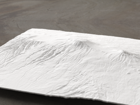
This is a scale model of the island of Maui, the second-largest and second-highest island in the Hawaiian Islands. There is a v-hook on the back placed on the back at the balancing point, so it can be hung on the wall or displayed on a table. The entire chain of 8 major islands is available at 1:500000 and 1:250000 scale, just click on the link below.
Model scale is 1:500000
Model covers an area approximately 46.4 by 31.7 miles
Altitudes covered: 0' to 10023'
This model was built with vertical exaggeration of 1:2.5. This means that the elevation is more steep and rugged in the model than in real life.
Click here for more sizes.
Click here for other 1:500000 models.
TinyMtn Navigator models are strongest and most affordable in the "White Strong and Flexible" material. When you receive the model, there may still be Nylon dust on it from the printing process. Use either an airbrush, canned dust blower, or a soft old toothbrush to remove this dust. Do not get the "White Strong and Flexible" material wet, and don't prime it or use any oil-based paints on it. You can safely seal it with Polycrylic or a similar water-based clear spray sealant. Read more about this popular material here.
These models have been optimized for the above material, and are not offered in other materials for strength or cost reasons. If you need one in another material, please contact us and we'll do our best to fulfill your request.
(C) 2015 TinyMtn (TM)
Model created using GDAL, NetPBM, Gmsh, Carve, MeshLab, and other custom software
Source of digital elevation data: U.S. Geological Survey
The USGS home page is https://www.usgs.gov/
Details

