


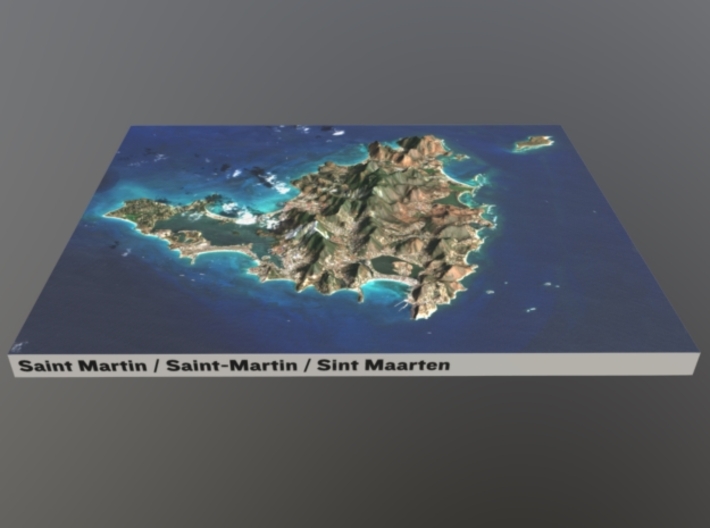

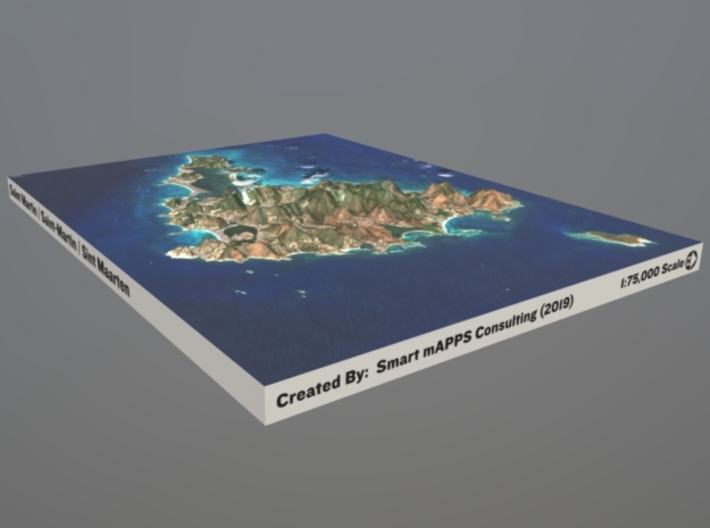

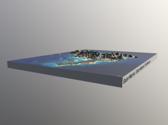
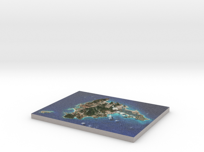
Saint Martin / Sint Maarten Terrain Map
Made by
Print With Shapeways
 Choose Your Material
 Choose your color and finish
$269.52
Have a question about this product?
contact the designerYou must be logged in and verified to contact the designer.
Product Description
Interactive 3D View
If you would like a custom relief map, contact me through my website or through Shapeways. Check out photos of my other 3D prints.
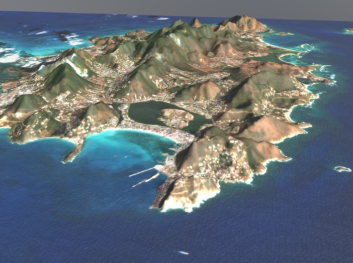
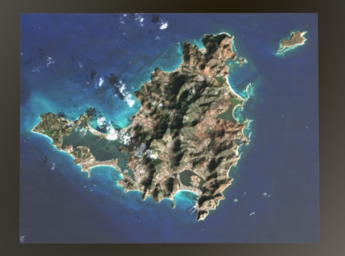
Saint Martin (French: Saint-Martin; Dutch: Sint Maarten) is an island in the northeast Caribbean Sea, approximately 300 km (190 mi) east of Puerto Rico. The 87-square-kilometre (34 sq mi) island is divided roughly 60/40 between the French Republic (53 km2, 20 sq mi)[1] and the Kingdom of the Netherlands (34 km2, 13 sq mi), but the two parts are roughly equal in population. The division dates to 1648. The southern Dutch part comprises Sint Maarten and is one of four constituent countries that form the Kingdom of the Netherlands. The northern French part comprises the Collectivity of Saint Martin and is an overseas collectivity of France. Only the French part of the island is part of the European Union.
The model is created at a scale of 1:750,000 with 2x vertical exaggeration. It features a built-in base, so it sits perfectly on a desk or in a frame.
Model Data Sources: JAXA (Elevation), ESA (Imagery)
If you would like a custom relief map, contact me through my website or through Shapeways. Check out photos of my other 3D prints.
Saint Martin (French: Saint-Martin; Dutch: Sint Maarten) is an island in the northeast Caribbean Sea, approximately 300 km (190 mi) east of Puerto Rico. The 87-square-kilometre (34 sq mi) island is divided roughly 60/40 between the French Republic (53 km2, 20 sq mi)[1] and the Kingdom of the Netherlands (34 km2, 13 sq mi), but the two parts are roughly equal in population. The division dates to 1648. The southern Dutch part comprises Sint Maarten and is one of four constituent countries that form the Kingdom of the Netherlands. The northern French part comprises the Collectivity of Saint Martin and is an overseas collectivity of France. Only the French part of the island is part of the European Union.
The model is created at a scale of 1:750,000 with 2x vertical exaggeration. It features a built-in base, so it sits perfectly on a desk or in a frame.
Model Data Sources: JAXA (Elevation), ESA (Imagery)
Details
What's in the box:
St-Martin-8.5x11-75k
Dimensions:
Success Rate:
First To try.
What's this?
Rating:
Mature audiences only.


