


Kauaʻi Map, Hawaiian Islands
Made by
Print With Shapeways
 Choose Your Material
 Choose your color and finish
$354.67
Have a question about this product?
contact the designerYou must be logged in and verified to contact the designer.
Product Description
If you would like a custom relief map, contact me through my website or through Shapeways. Check out photos of my other 3D prints.
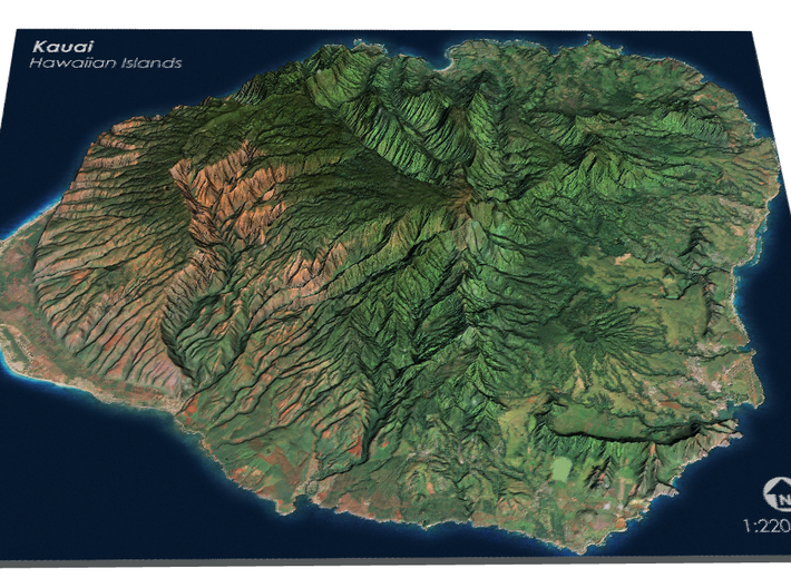
Kauaʻi, anglicized as Kauai[a] (English: /kəˈwaɪ.i/; Hawaiian: [kɐˈwɐʔi]), is geologically the oldest of the main Hawaiian Islands. With an area of 562.3 square miles (1,456.4 km2), it is the fourth largest of these islands and the 21st largest island in the United States.[3] Known also as the "Garden Isle", Kauaʻi lies 105 miles (169 km) across the Kauaʻi Channel, northwest of Oʻahu. This island is the site of Waimea Canyon State Park.
The United States Census Bureau defines Kauaʻi as census tracts 401 through 409 of Kauai County, Hawaiʻi, which comprises all of the county except for the islands of Kaʻula, Lehua and Niʻihau. The 2010 United States Census population of the island was 67,091.[4] The most populous town was Kapaʻa.
Source: Wikipedia
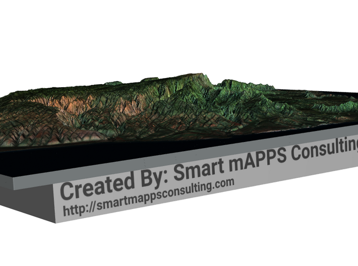
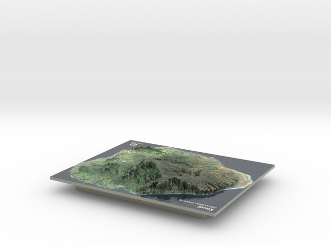
The model is created at a scale of 1:220,000 with 2x vertical exaggeration. It features a built-in base, so it sits perfectly on a desk or in a frame.
Model Data Sources: USGS
Kauaʻi, anglicized as Kauai[a] (English: /kəˈwaɪ.i/; Hawaiian: [kɐˈwɐʔi]), is geologically the oldest of the main Hawaiian Islands. With an area of 562.3 square miles (1,456.4 km2), it is the fourth largest of these islands and the 21st largest island in the United States.[3] Known also as the "Garden Isle", Kauaʻi lies 105 miles (169 km) across the Kauaʻi Channel, northwest of Oʻahu. This island is the site of Waimea Canyon State Park.
The United States Census Bureau defines Kauaʻi as census tracts 401 through 409 of Kauai County, Hawaiʻi, which comprises all of the county except for the islands of Kaʻula, Lehua and Niʻihau. The 2010 United States Census population of the island was 67,091.[4] The most populous town was Kapaʻa.
Source: Wikipedia
The model is created at a scale of 1:220,000 with 2x vertical exaggeration. It features a built-in base, so it sits perfectly on a desk or in a frame.
Model Data Sources: USGS
Details
What's in the box:
Kauai, Hawaiian Islands
Dimensions:
Success Rate:
First To try.
What's this?
Rating:
Mature audiences only.


