


Wizard Island Map
Made by
Print With Shapeways
 Choose Your Material
 Choose your color and finish
$200.70
Have a question about this product?
contact the designerYou must be logged in and verified to contact the designer.
Product Description
Interactive 3D View
If you would like a custom relief map, contact me through my website or through Shapeways.
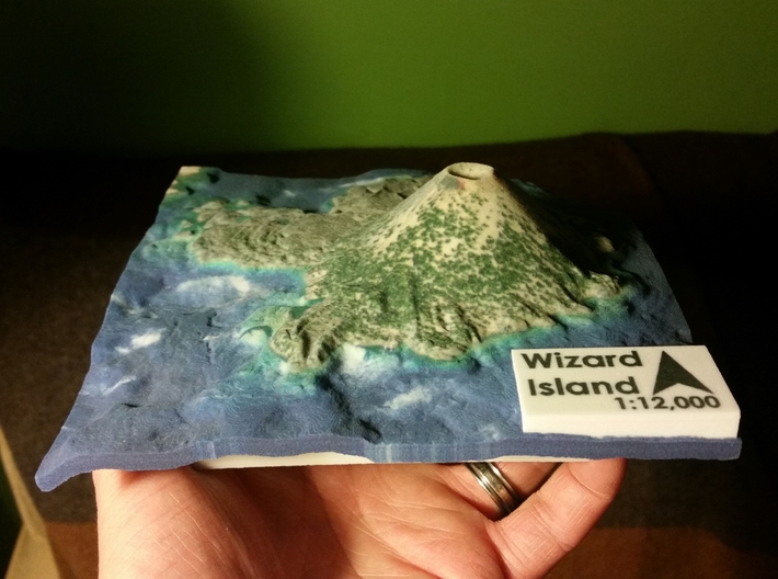
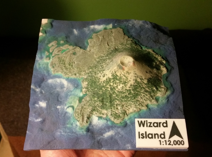
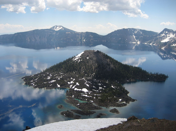
Wizard Island is a volcanic cinder cone which forms an island at the west end of Crater Lake in Crater Lake National Park, Oregon. The top of the island reaches 6,933 feet (2,113 m) above sea level, about 755 feet (230 m) above the average surface of the lake. The cone is capped by a volcanic crater about 500 feet (150 m) wide and 100 feet (30 m) deep. The crater was named the "Witches Cauldron" by Will G. Steel in 1885, who also gave Wizard Island its name at the same time.[5] The land area of the island is 315.85 acres (127.82 ha).
Source: Wikipedia
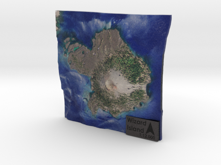
This 3D relief map was created at a scale of 1:12,000 without any vertical exaggeration. The model covers approximately 1.27 sq. miles.
If you would like a custom relief map, contact me through my website or through Shapeways.
Wizard Island is a volcanic cinder cone which forms an island at the west end of Crater Lake in Crater Lake National Park, Oregon. The top of the island reaches 6,933 feet (2,113 m) above sea level, about 755 feet (230 m) above the average surface of the lake. The cone is capped by a volcanic crater about 500 feet (150 m) wide and 100 feet (30 m) deep. The crater was named the "Witches Cauldron" by Will G. Steel in 1885, who also gave Wizard Island its name at the same time.[5] The land area of the island is 315.85 acres (127.82 ha).
Source: Wikipedia
This 3D relief map was created at a scale of 1:12,000 without any vertical exaggeration. The model covers approximately 1.27 sq. miles.
Details
What's in the box:
Wizard Island Map

Dimensions:
Success Rate:
First To try.
What's this?
Rating:
Mature audiences only.


