


Egmont National Park Map
Made by
Print With Shapeways
 Choose Your Material
 Choose your color and finish
$287.26
Have a question about this product?
contact the designerYou must be logged in and verified to contact the designer.
Product Description
If you would like a custom relief map, contact me through my website or through Shapeways. Check out photos of my other 3D prints.
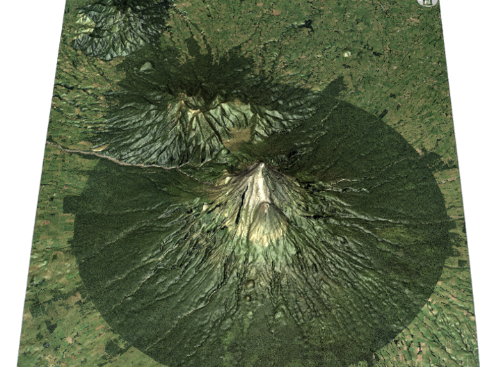
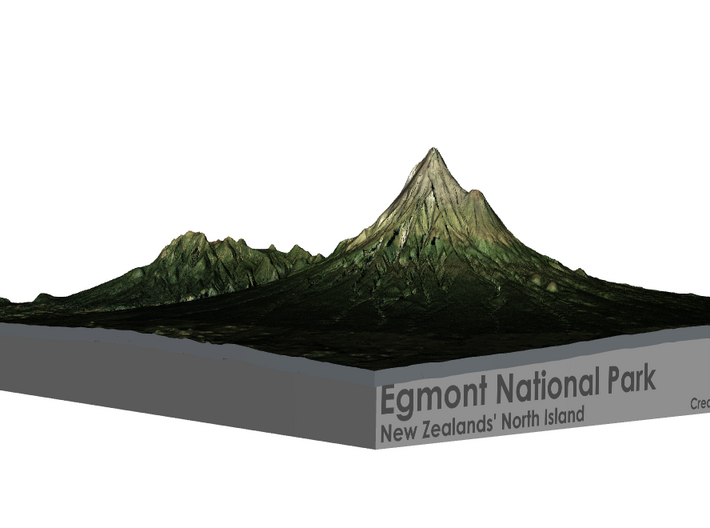
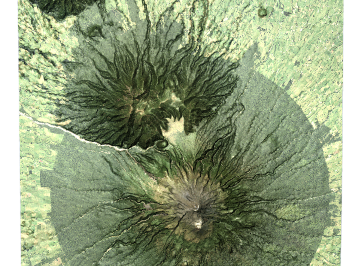
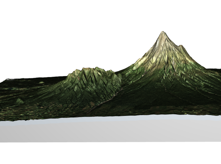
Egmont National Park is located south of New Plymouth, close to the west coast of the North Island of New Zealand. It is named after the mountain which dominates its environs, which itself was named by Captain Cook after John Perceval, 2nd Earl of Egmont, the First Lord of the Admiralty who promoted Cook's first voyage. Taranaki has been the Māori name for the mountain for many centuries, and the mountain itself now has two alternative official names, "Mount Taranaki" and "Mount Egmont".
The park, established in 1900, is dominated by the dormant volcano of Mount Taranaki.[1] The park receives massive annual precipitation which is essentially orographic in origin as moist westerlies moving inland from the Tasman hit Mount Taranaki and the adjacent Pouakai and Kaitake ranges and are thus forced to rise. Since the area has high annual rainfall and a mild coastal climate there is a lush rainforest covering the foothills, a forest which is nationally significant for the total absence of beech trees (genus Nothofagus).
Source: Wikipedia
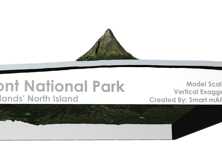
The model is created at a scale of 1:30,000 with 1.5x vertical exaggeration. It features a built-in base, so it sits perfectly on a desk or in a frame.
Model Data Sources: Land Information New Zealand (LINZ)
Egmont National Park is located south of New Plymouth, close to the west coast of the North Island of New Zealand. It is named after the mountain which dominates its environs, which itself was named by Captain Cook after John Perceval, 2nd Earl of Egmont, the First Lord of the Admiralty who promoted Cook's first voyage. Taranaki has been the Māori name for the mountain for many centuries, and the mountain itself now has two alternative official names, "Mount Taranaki" and "Mount Egmont".
The park, established in 1900, is dominated by the dormant volcano of Mount Taranaki.[1] The park receives massive annual precipitation which is essentially orographic in origin as moist westerlies moving inland from the Tasman hit Mount Taranaki and the adjacent Pouakai and Kaitake ranges and are thus forced to rise. Since the area has high annual rainfall and a mild coastal climate there is a lush rainforest covering the foothills, a forest which is nationally significant for the total absence of beech trees (genus Nothofagus).
Source: Wikipedia
The model is created at a scale of 1:30,000 with 1.5x vertical exaggeration. It features a built-in base, so it sits perfectly on a desk or in a frame.
Model Data Sources: Land Information New Zealand (LINZ)
Details
What's in the box:
Egmont National Park

Dimensions:
Success Rate:
First To try.
What's this?
Rating:
Mature audiences only.


