


Mt Taranaki Map - 9" Contour
Made by
Print With Shapeways
 Choose Your Material
 Choose your color and finish
$339.33
Have a question about this product?
contact the designerYou must be logged in and verified to contact the designer.
Product Description
If you would like a custom relief map, contact me through my website or through Shapeways.
Other Size/Style Options
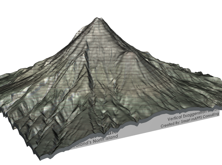
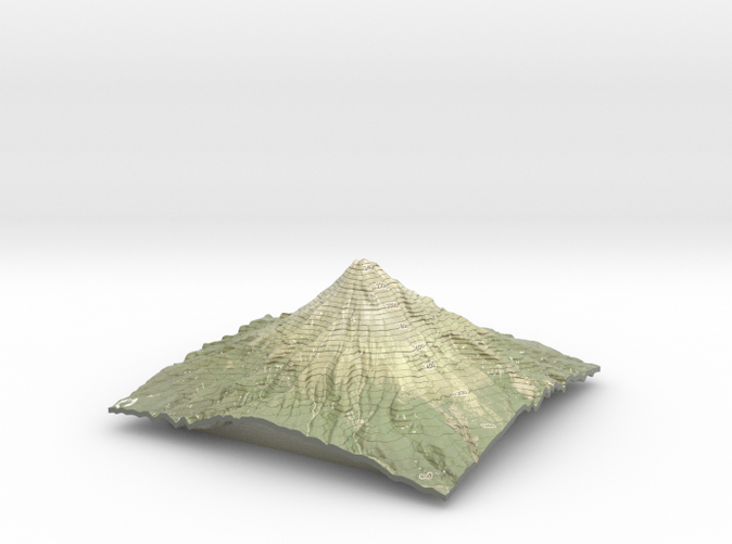
Mount Taranaki is New Zealand's most perfectly formed volcano. It is around 120,000 years old and last erupted in 1775 and volcanologists agree that the mountain is 'dormant' rather than extinct. Often described as ‘New Zealand’s most climbed mountain’, Mt Taranaki provides non-mountaineers with an achievable summit challenge.
At lower altitudes you'll walk through tall rimu and kamahi trees; higher up the volcano, sub-alpine shrubs and herbfields are found above the snow line. Lush rainforests can be found on the mountain’s slopes and are a result of the area’s high rainfall and mild coastal climate.
The walking track network in this national park is extensive, ranging from a 15 minute stroll along the Kamahi Track to the three-day Pouakai Circuit. There's a veritable maze of tracks around the Dawson Falls area, including the walk to Wilkies Pools, a series of eroded rock pools connected with gentle waterfalls.
Taranaki is linked by legend to the mountains of the central North Island. As the story goes, Taranaki once lived with the other volcanoes of the central plateau - Tongariro, Ruapehu and Ngauruhoe. When he made flirtatious advances towards a pretty hill named Pihanga, Tongariro erupted in a jealous fury. Taranaki fled to the west, gouging out the Whanganui River on his way. Today Taranaki is still venerated and its summit is sacred to the Maori people of the area.
Source: NewZealand.com
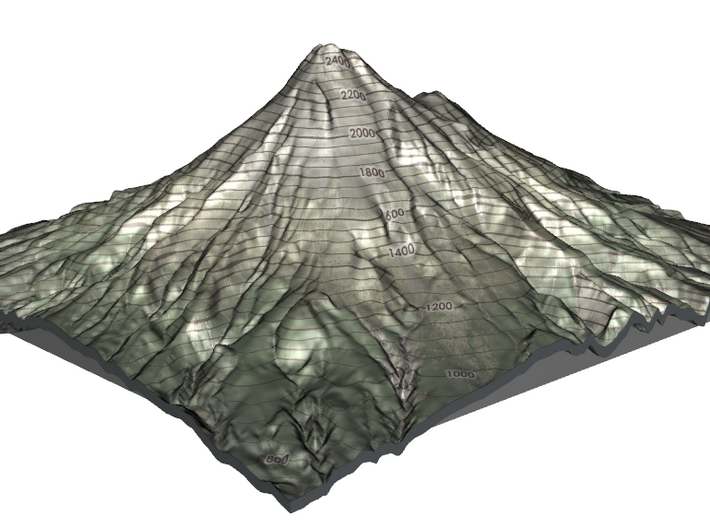
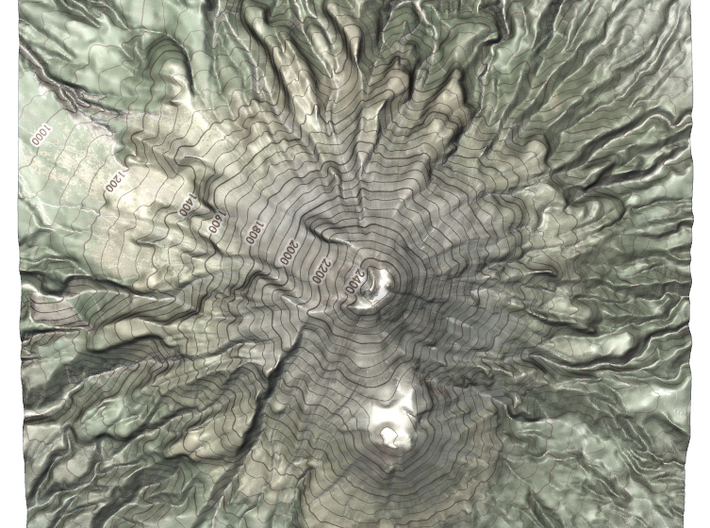
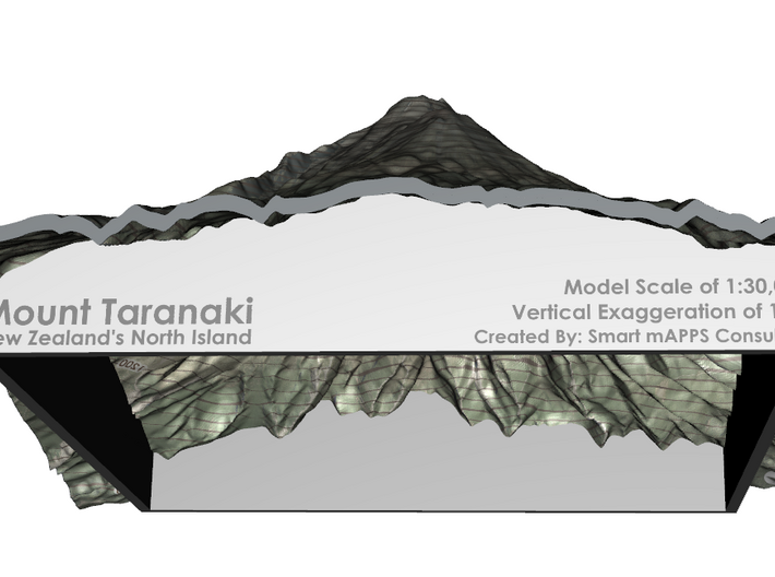
The model is created at a scale of 1:30,000 with a vertical exaggeration of 1.5x. It features a built-in base, so it sits perfectly on a desk or in a frame.
Model Data Sources: Land Information New Zealand (LINZ)
Other Size/Style Options
Mount Taranaki is New Zealand's most perfectly formed volcano. It is around 120,000 years old and last erupted in 1775 and volcanologists agree that the mountain is 'dormant' rather than extinct. Often described as ‘New Zealand’s most climbed mountain’, Mt Taranaki provides non-mountaineers with an achievable summit challenge.
At lower altitudes you'll walk through tall rimu and kamahi trees; higher up the volcano, sub-alpine shrubs and herbfields are found above the snow line. Lush rainforests can be found on the mountain’s slopes and are a result of the area’s high rainfall and mild coastal climate.
The walking track network in this national park is extensive, ranging from a 15 minute stroll along the Kamahi Track to the three-day Pouakai Circuit. There's a veritable maze of tracks around the Dawson Falls area, including the walk to Wilkies Pools, a series of eroded rock pools connected with gentle waterfalls.
Taranaki is linked by legend to the mountains of the central North Island. As the story goes, Taranaki once lived with the other volcanoes of the central plateau - Tongariro, Ruapehu and Ngauruhoe. When he made flirtatious advances towards a pretty hill named Pihanga, Tongariro erupted in a jealous fury. Taranaki fled to the west, gouging out the Whanganui River on his way. Today Taranaki is still venerated and its summit is sacred to the Maori people of the area.
Source: NewZealand.com
The model is created at a scale of 1:30,000 with a vertical exaggeration of 1.5x. It features a built-in base, so it sits perfectly on a desk or in a frame.
Model Data Sources: Land Information New Zealand (LINZ)
Details
What's in the box:
Mt Taranaki Contour
Dimensions:
Success Rate:
First To try.
What's this?
Rating:
Mature audiences only.


