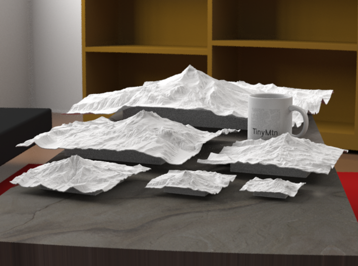
Radiance rendering of all available sizes: 3", 4", 6", 8", 12", 20".


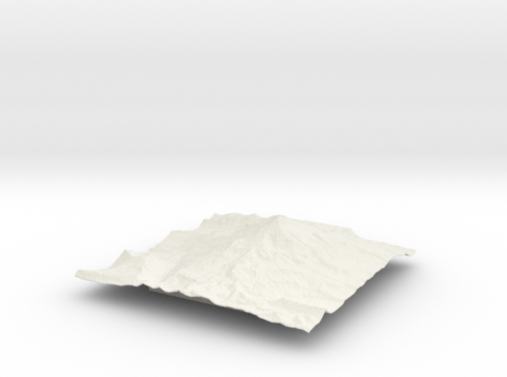
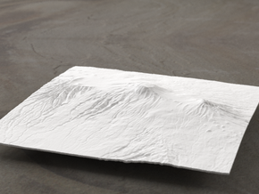
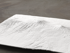
12'' Mt. Jefferson, Oregon, USA
Made by
Print With Shapeways
 Choose Your Material
 Choose your color and finish
$399.00
Have a question about this product?
contact the designerYou must be logged in and verified to contact the designer.
Product Description
Mount Jefferson, standing at 10,502 ft/ 3,200 m (NAVD88), is the second tallest mountain in Oregon and a prominent landmark in Oregon's High Cascades region. Jefferson's rugged and glacially scarred face attracts many photographers and hikers to its pristine slopes. Because the average elevation around the mountain stays around 5,000 feet, Jefferson has a prominence of over 5,000 feet! The lush western slopes of the mountain are protected within the Mount Jefferson Wilderness, an ecologically complex area protecting 111,177 acres of pristine and ancient conifer forests, rocky outcrops, talus slopes, and scenic alpine meadows. The drier eastern side is within the Warm Springs Indian Reservation. There are over 150 lakes on and around the mountain, and over 190 miles of trails in the wilderness. The Pacific Crest Trail, which runs from Mexico to Canada, runs for 40 miles through the wilderness. One of the more popular areas on Mount Jefferson include the Jefferson Park, known for its wildflower-filled meadows, scenic lakes, and photogenic views of the mountain.
Model scale is 1:33400
Model covers an area approximately 6.2 by 6.2 miles
Altitudes covered: 3508' to 10502'
There is never any vertical exaggeration in TinyMtn models.
Click here for more sizes.
Click here for other 12" models.
TinyMtn models are most affordable in the "White Strong and Flexible" and "Sandstone" materials. This model is in "White Strong and Flexible." When you receive the model, there may still be Nylon dust on it from the printing process. Use either an airbrush, canned dust blower, or a soft old toothbrush to remove this dust. Do not get the "White Strong and Flexible" material wet, and don't prime it or use any oil-based paints on it. You can safely seal it with Polycrylic or a similar water-based clear spray sealant. Read more about this popular material here.
These models have been optimized for the above materials, and are not offered in other materials for strength or cost reasons. If you need one in another material, please tinymtnbiz@gmail.com and we'll try to accommodate your request.
(C) 2014 TinyMtn (TM)
Model created using GDAL, NetPBM, Gmsh, Carve, MeshLab, and other custom software
Source of digital elevation data: U.S. Geological Survey
The USGS home page is https://www.usgs.gov/
Request a custom order
and get this product personalized just for you
Details
What's in the box:
12'' Mt. Jefferson, Oregon, USA, WSF

Dimensions:
Success Rate:
First To try.
What's this?
Rating:
Mature audiences only.
