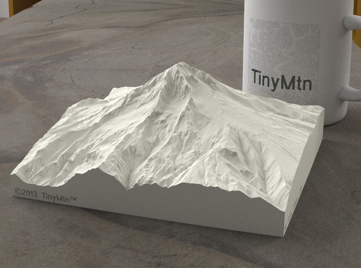


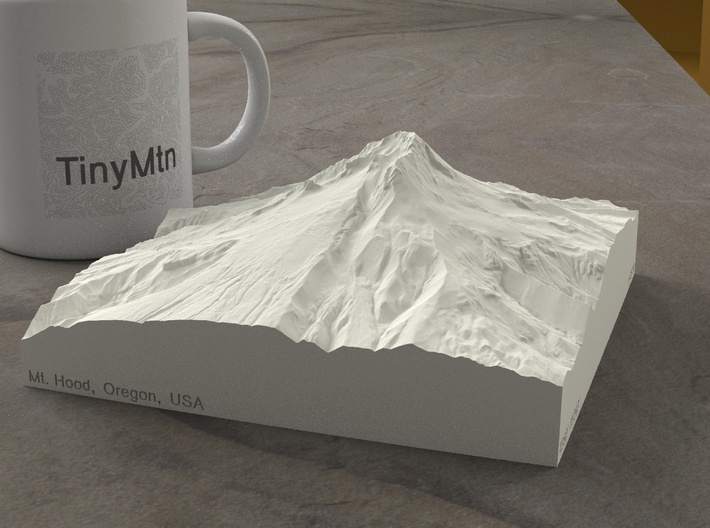

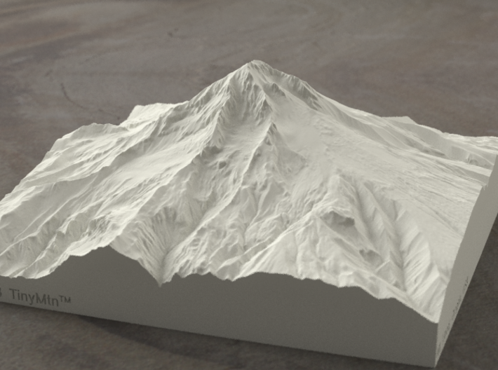


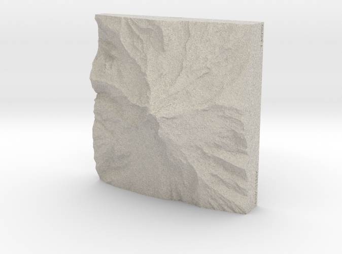
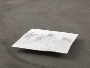
6'' Mt. Hood, Oregon, USA, Sandstone
Made by
Print With Shapeways
 Choose Your Material
 Choose your color and finish
$141.52
Have a question about this product?
contact the designerYou must be logged in and verified to contact the designer.
Product Description
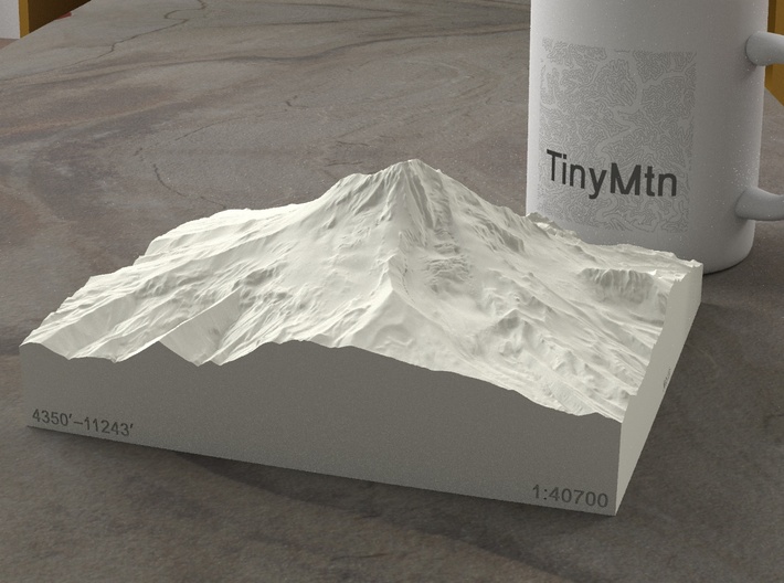
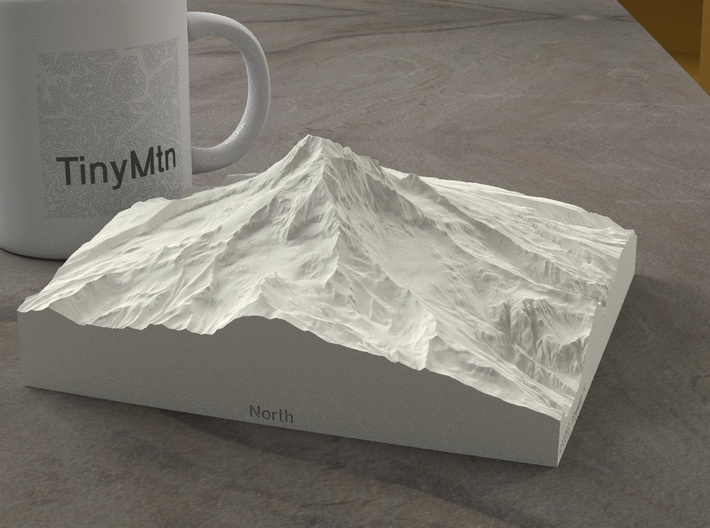
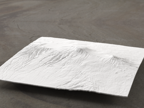
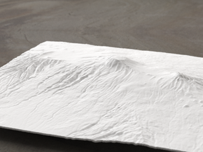
Though at 11243' it is only 650' higher than Interstate 70 at Vail Pass, Mt. Hood is the highest point in Oregon and the fourth-highest peak in the Cascades. It is a potentially-active stratovolcano (named after the many layers, or strata, of which it is composed) whose last major eruption was just over 230 years ago. This model showcases Mt. Hood's summit, including a detailed Crater Rock and Devil's Kitchen Headwall, all the way down to steep valleys at 4350' (well below the treeline). We hope seeing this model on your desk inspires you to become one of the roughly 10,000 people who attempt the summit every year (if you are not one of them already!).
Other features of this 3d printed map are Illumination Rock and Hot Rocks at the top of Zigzag Glacier and Mississippi Head at its base, Yocum Ridge and numerous crevasses in Reid Glacier, a prominent Pulpit Rock overlooking Coe Glacier and the tip of the Barrett Spur, a deeply-crevassed Eliat Glacier next to Cooper Spur, and the top reaches of the Mount Hood Meadow Ski Area.
Model scale is 1:40700
Model covers an area approximately 3.8 by 3.8 miles
Altitudes covered: 4350' to 11243'
There is never any vertical exaggeration in TinyMtn models.
Click here for more sizes.
Click here for other 6" models.
TinyMtn models are most affordable in the "Sandstone" and "White Strong and Flexible" materials. This model is in "Sandstone," which is a glued gypsum material. When you receive the model it will be ready for display, though it may smell funny and need some time to air out. "Sandstone" models are much more brittle than "White Strong and Flexible" models, but feel more like light stone. Do not soak it in water, though you can safely seal it with Polycrylic or a similar water-based clear spray sealant. Read more about this popular material here.
These models have been optimized for the above materials, and are not offered in other materials for strength or cost reasons. If you need one in another material, please tinymtnbiz@gmail.com and we'll try to accommodate your request.
(C) 2013 TinyMtn (TM)
Model created using GDAL, NetPBM, Gmsh, Carve, MeshLab, and other custom software
Source of digital elevation data: U.S. Geological Survey
The USGS home page is http://www.usgs.gov/
Request a custom order
and get this product personalized just for you
Details
What's in the box:
6'' Mt. Hood, Oregon, USA, Sandstone
Dimensions:
Success Rate:
First To try.
What's this?
Rating:
Mature audiences only.
