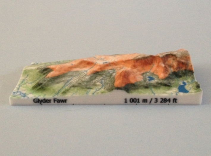


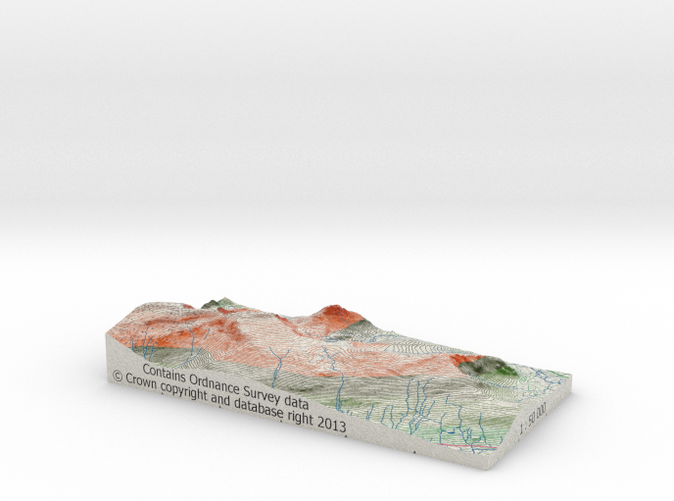
Glyder Fawr - Relief
Made by
Have a question about this product?
contact the designerProduct Description
OVERVIEW:
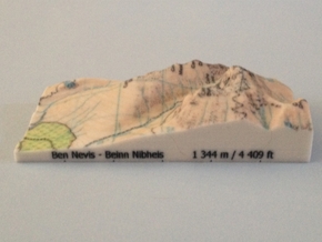
The product is a full colour, hollow 3D terrain model of Glyder Fawr based on Ordnance Survey elevation data draped with an Ordnance Survey OpenData 1:50,000 map image.
It is an ideal gift for a mountain walker, mountain lover or a map enthusiast, or an attractive souvenir for anyone who has visited the eastern part of the Glyderau range and has admired the shapeliness of Glyder Fawr and its neighbouring peaks. The model can be put on display as an eye-catching ornament or memento that will be sure to be a conversation piece. It could also be a useful tool for a geography teacher or navigation instructor who wants to demonstrate how 3D terrain relates to its representation on maps.
The vertical scale of the model has not been exaggerated and the model is therefore is accurate to scale. The 3D model is aligned to the UK National Grid with the 1 km grid lines etched on the bottom of the walls of the model.
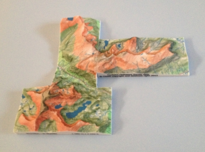
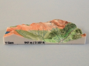
In addition to Glyder Fawr, the model also features Glyder Fach and Tryfan. The model can be placed alongside the Y Garn - Relief model to form a larger "model" and, if all five Welsh 3000 ft Peaks models are purchased, it could form one large "model" that includes all the 3000 ft peaks in Wales.
SURFACE DETAIL:
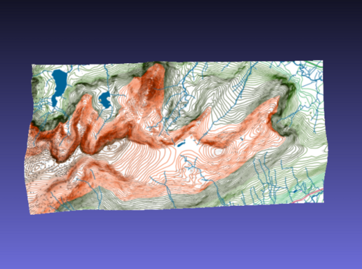
Upper surface: A map designed from Ordnance Survey OpenData showing crags, contours (with a different colour to represent each 1000 foot range of heights), ridges, valleys, cwms, crags, lakes and water courses.
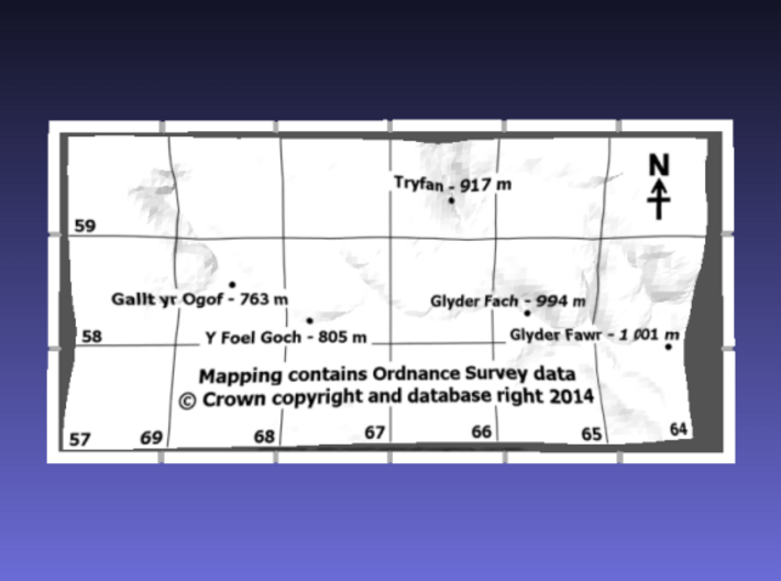
Underside: labelled grid lines, the names, positions and heights of all the Hewitts (Hills in England, Wales and Ireland over Two Thousand feet), a compass arrow indicating the North direction and an acknowledgement to the Ordnance Survey for the OpenData map imagery with their copyright notice
North wall: the name of the main peak in and its height in meters and feet
East wall: the scale of the model
South wall: an acknowledgement to the Ordnance Survey for the elevation data with their copyright notice
West wall: the branding "Mountain Shapes"
SPECIFICATIONS:
Horizontal scale: 1:50,000
Vertical scale: 1:50,000
Material: Full Color Sandstone - a hard brittle plaster-like material with a granular look and feel. The model could be damaged if dropped onto a hard surface, knocked by a hard object, exposed to water, heat or strong sunlight for prolonged periods.
Size of area modelled: 6 km x 3 km (120 mm x 60 mm in model)
Thickness of walls: 2 mm
Volume of material: 21.7 cc
Weight of model: 34 g
Grid reference of centre of model: SH 67000 58500 (267000, 358500)
Source of elevation data: Ordnance Survey OpenData Terrain 50
Elevation sampling interval: 50 m (1 mm in model) at the centre of 50 m grid squares with interpolation from neighbouring samples at the edges of the model which are on grid lines, 25 m (0.5 mm in model) from nearest sampled elevations
Maximum elevation: 992 m (19.8 mm in model)
Minimum elevation: 177 m (3.5 mm in model)
Source of map imagery: Ordnance Survey OpenData VectorMap District
Source of mountain attribute data: The Database of British and Irish Hills
Details
