


Senja Map, Norway 4x6
Made by
Print With Shapeways
 Choose Your Material
 Choose your color and finish
$120.08
Have a question about this product?
contact the designerYou must be logged in and verified to contact the designer.
Product Description
If you would like a custom relief map, contact me through my website or through Shapeways. Check out photos of my other 3D prints.
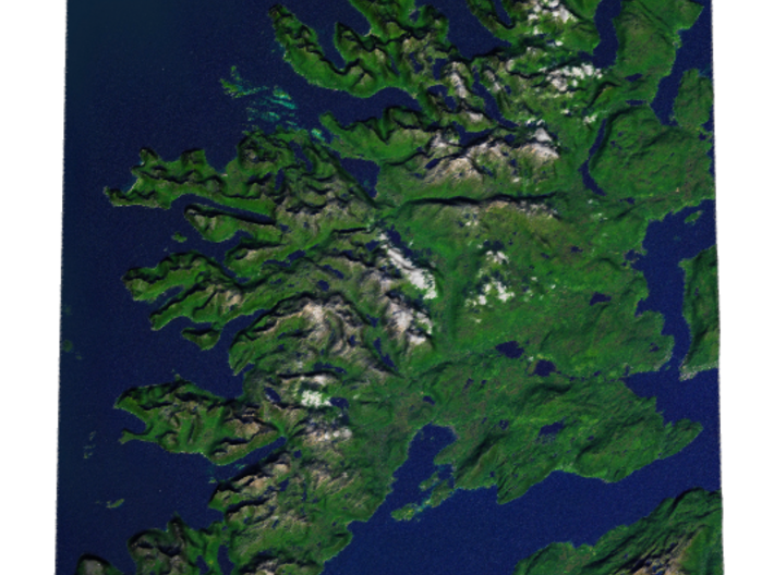
Senja is located along the Troms county coastline with Finnsnes as the closest town. Senja is connected to the mainland by the Gisund Bridge. The municipalities located on Senja are Lenvik (part of which is on the mainland), Berg, Torsken, and Tranøy. Senja had 7782 inhabitants as of 1 January 2008.
The northern coasts of Senja faces the open sea, the western coast faces Andøya and Krøttøya, the southern coast faces Andørja and Dyrøya. Here, on the western coast, steep and rugged mountains rise straight from the sea, with some fishing villages (like Gryllefjord, Husøy) wherever there is some lowland. The eastern and southern parts of the island are milder, with rounder mountains, forests, rivers and agriculture land.
Senja is often referred to as "Norway in miniature", as the island's diverse scenery reflects almost the entire span of Norwegian nature. Senja is well known domestically for its beautiful scenery, and is marketed as a tourist attraction.
Source: Wikipedia
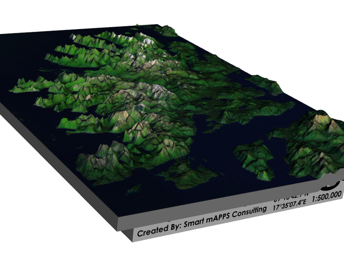
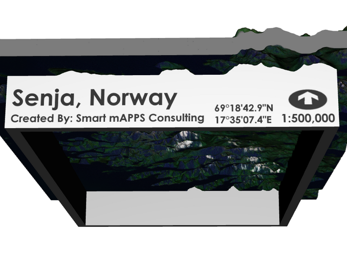
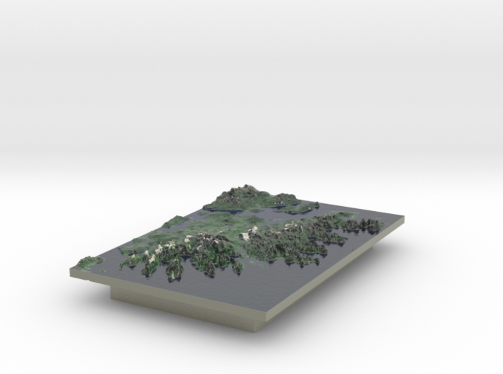
The model is created at a scale of 1:500,000 with 2.5x vertical exaggeration. It features a built-in base, so it sits perfectly on a desk or in a frame.
Model Data Sources: Norwegian Mapping Authority and USGS
Senja is located along the Troms county coastline with Finnsnes as the closest town. Senja is connected to the mainland by the Gisund Bridge. The municipalities located on Senja are Lenvik (part of which is on the mainland), Berg, Torsken, and Tranøy. Senja had 7782 inhabitants as of 1 January 2008.
The northern coasts of Senja faces the open sea, the western coast faces Andøya and Krøttøya, the southern coast faces Andørja and Dyrøya. Here, on the western coast, steep and rugged mountains rise straight from the sea, with some fishing villages (like Gryllefjord, Husøy) wherever there is some lowland. The eastern and southern parts of the island are milder, with rounder mountains, forests, rivers and agriculture land.
Senja is often referred to as "Norway in miniature", as the island's diverse scenery reflects almost the entire span of Norwegian nature. Senja is well known domestically for its beautiful scenery, and is marketed as a tourist attraction.
Source: Wikipedia
The model is created at a scale of 1:500,000 with 2.5x vertical exaggeration. It features a built-in base, so it sits perfectly on a desk or in a frame.
Model Data Sources: Norwegian Mapping Authority and USGS
Details
What's in the box:
Senja, Norway 4x6

Dimensions:
Success Rate:
First To try.
What's this?
Rating:
Mature audiences only.


