


Hawaiian Islands Map
Made by
Print With Shapeways
 Choose Your Material
 Choose your color and finish
$358.06
Have a question about this product?
contact the designerYou must be logged in and verified to contact the designer.
Product Description
If you would like a custom relief map, contact me through my website or through Shapeways.
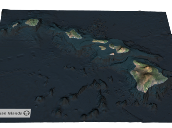
The Hawaiian Islands (Hawaiian: Mokupuni o Hawai‘i) are an archipelago of eight major islands, several atolls, numerous smaller islets, and undersea seamounts in the North Pacific Ocean, extending some 1,500 miles (2,400 kilometers) from the island of Hawaiʻi in the south to northernmost Kure Atoll. Formerly the group was known to Europeans and Americans as the "Sandwich Islands", a name chosen by James Cook in honor of the then First Lord of the Admiralty John Montagu, 4th Earl of Sandwich. The contemporary name is derived from the name of the main island, Hawaii Island.
Source: Wikipeida
Data Sources: National Oceanic and Atmospheric Administration (NOAA)
Request a custom order
and get this product personalized just for you
Details
What's in the box:
Hawaiian Islands

Dimensions:
Success Rate:
First To try.
What's this?
Rating:
Mature audiences only.


