

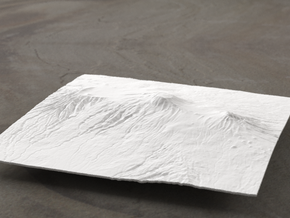
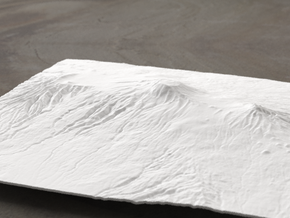
8''/20cm High Tatras, Poland/Slovakia, WSF
Made by
Have a question about this product?
contact the designerProduct Description
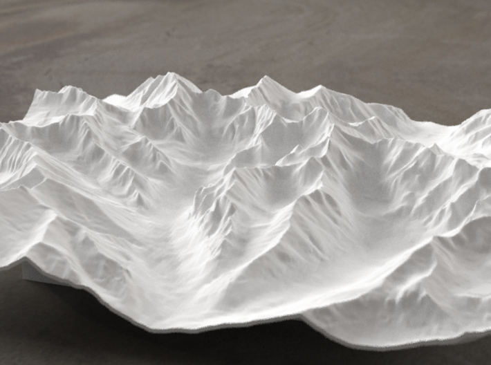
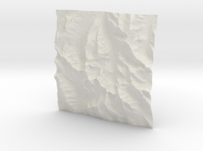
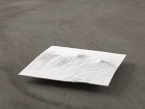
This is a model of the High Tatras, a mountain range on the border between Slovakia and Poland, and a very popular climbing area in Eastern Europe. The model includes Rysy, the highest peak in Poland, Gerlachovský štít, the highest point in Slovakia and the entire Carpathians, and a number of neighboring peaks and cirques.
Model scale is 1:45000
Model covers an area approximately 9 by 9 km
Altitudes covered: 1099m to 2654m
There is never any vertical exaggeration in TinyMtn models.
Click here for more sizes.
Click here for other 20cm models.
TinyMtn models are most affordable in the "White Strong and Flexible" and "Sandstone" materials. This model is in "White Strong and Flexible." When you receive the model, there may still be Nylon dust on it from the printing process. Use either an airbrush, canned dust blower, or a soft old toothbrush to remove this dust. Do not get the "White Strong and Flexible" material wet, and don't prime it or use any oil-based paints on it. You can safely seal it with Polycrylic or a similar water-based clear spray sealant. Read more about this popular material here.
The "Frosted Detail" material will show more detail, but is semi-transparent and has an uneven surface texture when unpainted (due to the orientation of the model when Shapeways prints it). It may show up feeling a little greasy and with small crystals in crevasses. Clean those off by soaking the model in warm (but not hot) soapy water and brushing with an old toothbrush. To get the surface to an even matte finish, spray with a few light coats of sandable primer (white automotive primer works), and then do a baking soda grit-blast.
These models have been optimized for the above materials, and are not offered in other materials for strength or cost reasons. If you need one in another material, please contact us and we'll try to accommodate your request.
(C) 2014 TinyMtn (TM)
Model created using GDAL, NetPBM, Gmsh, Carve, MeshLab, and other custom software
Source of digital elevation data: Viewfinder Panoramas
Viewfinder Panoramas provides cleaned and modified versions of DEM data
from ASTER GDEM, SRTM, and local sources. Data used without permission.
The Viewfinder Panoramas home page is http://www.viewfinderpanoramas.org/
Details

